redemption climb | gunn peak scramble
5.5 miles . 4300 ft gain . 6244 ft high
Wild Sky Wilderness
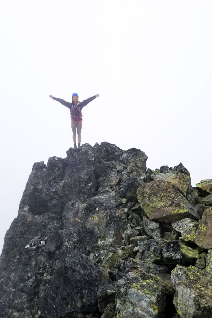
My first attempt of Gunn Peak was ambitious to say the least. Me and my two hiking buddies embarked on a journey that took much longer than any of us would have anticipated. It was difficult. But for me, I reveled in challenges and this offered just the right amount of route-finding and scrambling for me. I think I stood solidly in the middle between the skills of my friends, meaning I was probably having the most fun — I’m not always waiting and I’m not always trying to catch up. However, this post isn’t about that first climb. But rather, this second climb when we finally got clear skis and views for miles instead of clouds and views of 20 feet ahead of you. My initial climb was in such a white out, we could only move so fast, relying on my friend for her excellent navigation skills and expertise. We were so young then!
An advisory: It astounded me that I could complete this climbing 5.5 hours round trip including breaks and all. We really were hustling it this time around to make it back to Seattle by 5pm, except we got stuck in Sultan traffic! Truly, don’t schedule anything in the evening if you’re driving back through Sultan on Highway 2 on a sunny summer Sunday. Mistakes were made. Anyway, if you’re reading this, my disclaimer is that 5.5 hours is extremely fast. Most people we met along the trail were going much slower than this pace, probably on average they would be 7-9 hours round trip. The terrain is technical and strenuous, and I’m not stretching that by any means. If you do the math, you’re climbing 4300 ft in 2-1/4 miles. That’s like 2000 ft/mile. That’s steep! I cut down a lot of the time because I remembered the route from my first attempt and relied a little on my gps and visual cues to know where to go (and even I would get it wrong sometimes)
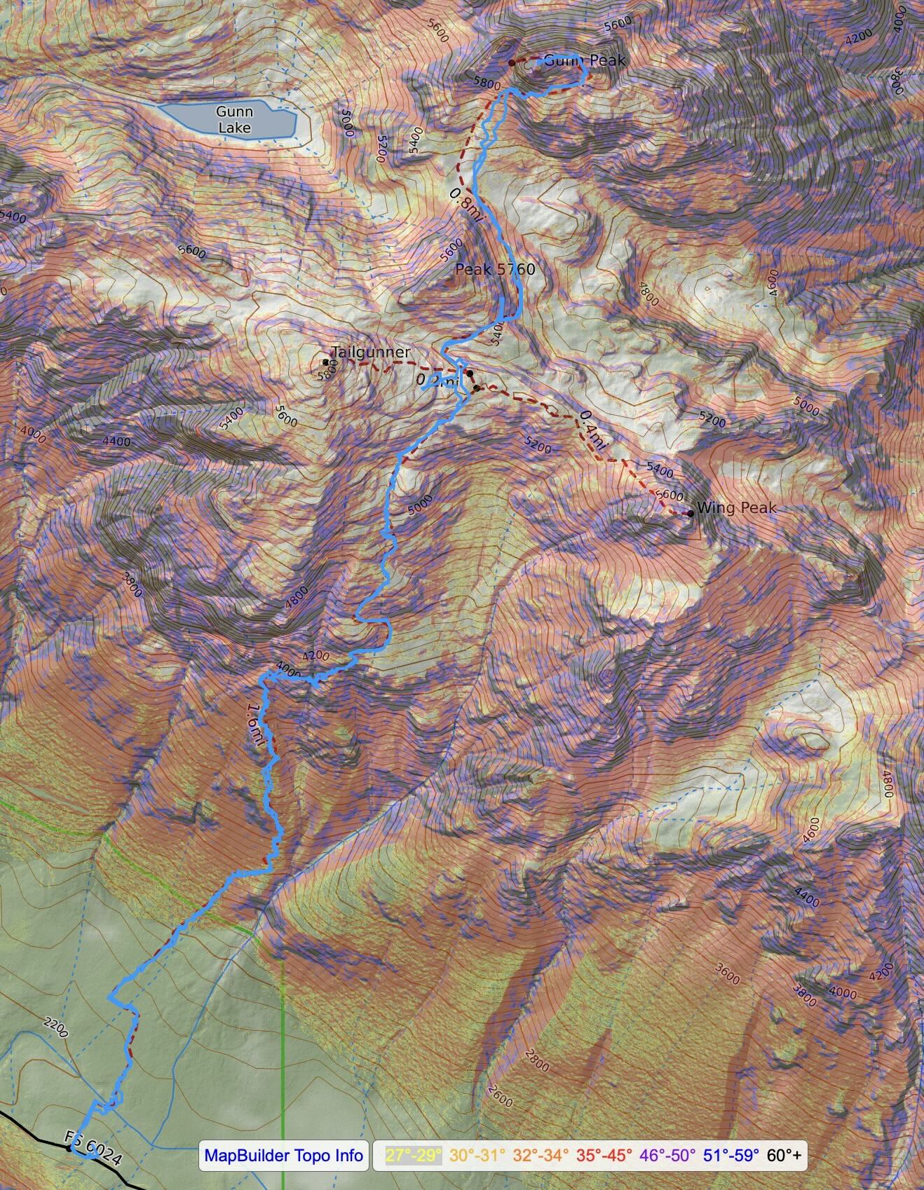
I digress. The trail starts a little ways before you hit the Barclay Lake Trailhead. That main trail goes to both the lake and the climber’s trail up to Mt Baring, one of my first Washington scrambles. There’s an old forest road that stretches maybe 100 yards before it reaches a creek. Honestly, don’t try to follow the trail too hard. Just get across the stream and then figure out how to get back on track. Maybe one day it’ll be flagged, but for now, it’s a lot of social trails that last maybe 20 feet before you hit the main trail. The main trail is quite lovely and cut back, nearly runnable!
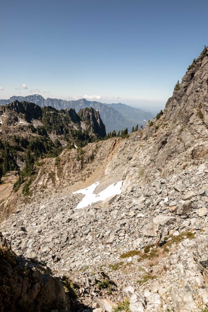
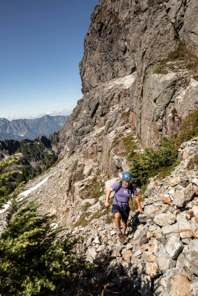
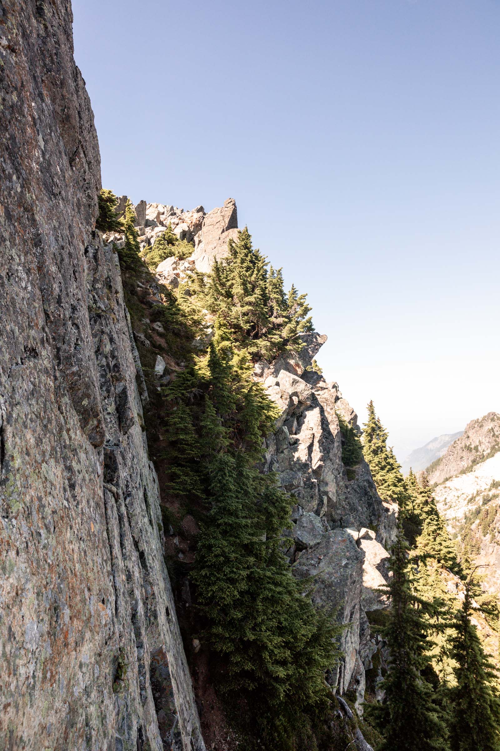
Once you’ve climbed 200 feet vertical on that trail, it gets steep with tiny switchbacks for the next 1500 ft. It’s a relentless up. For the most part the dirt is grippy and there were only small sections that felt like slippery dirt on the way down. At around 3800 ft, you’ll enter an opening where you’ll find a large rock face above you, head right immediately and don’t try scrambling the rock. This is not the time for a scramble. The trail traverses under another cliff band with trees downhill of you providing good shade. Then it starts slowly climbing up and winding its way another 1500 ft.
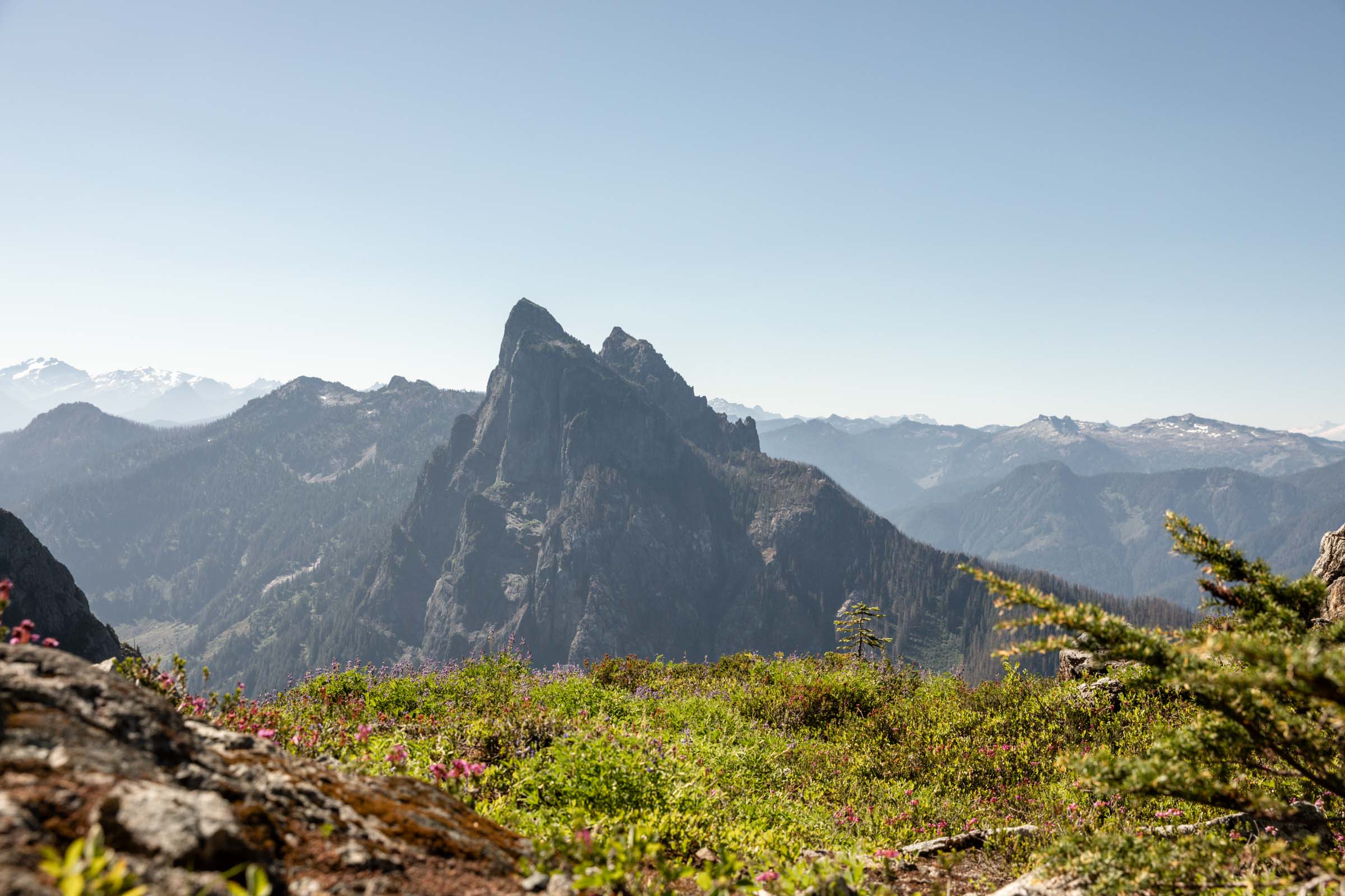
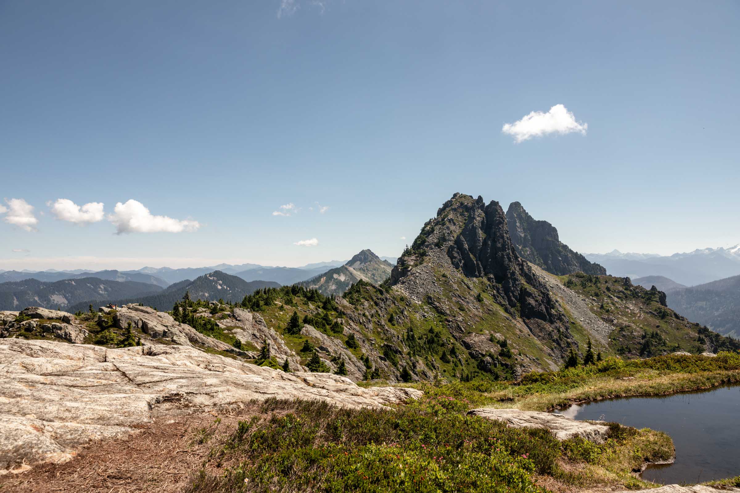

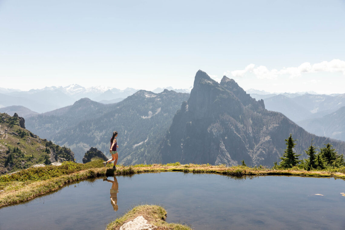
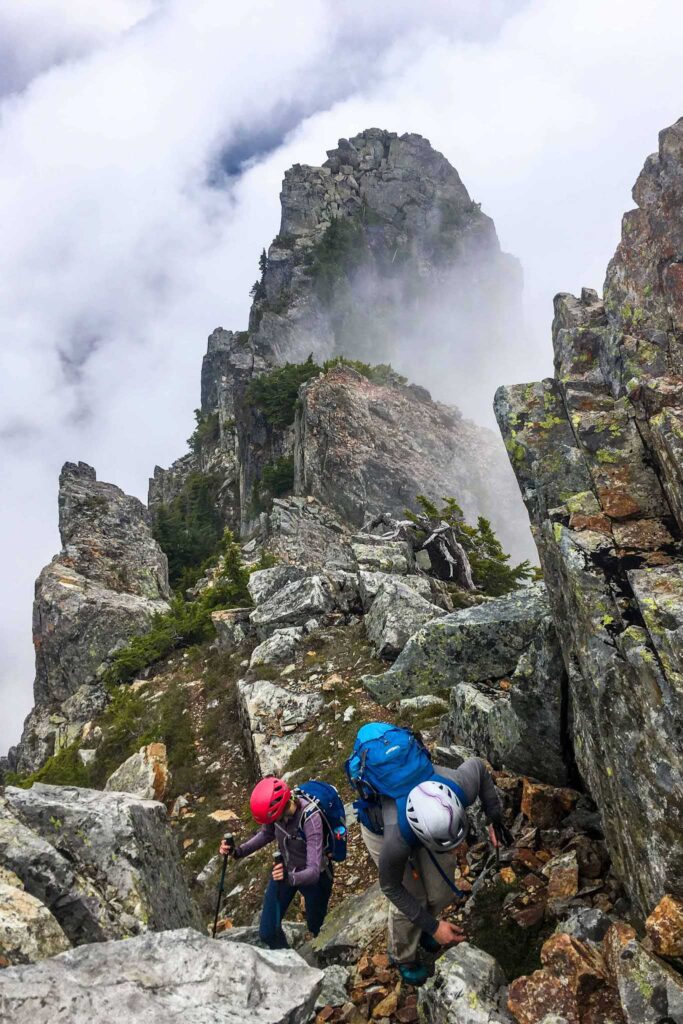
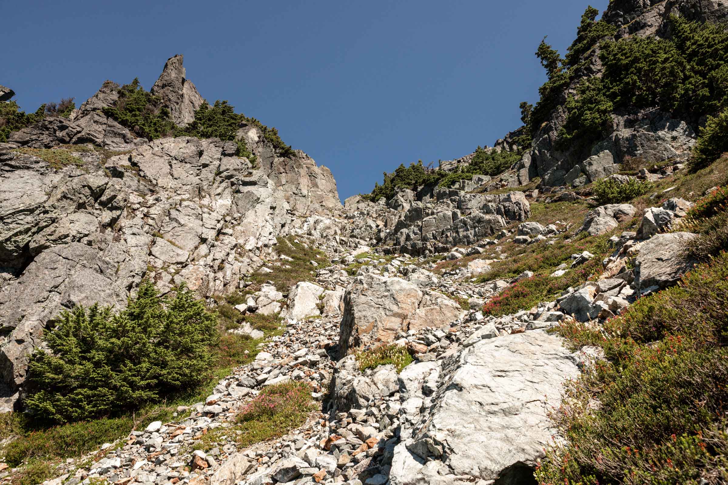
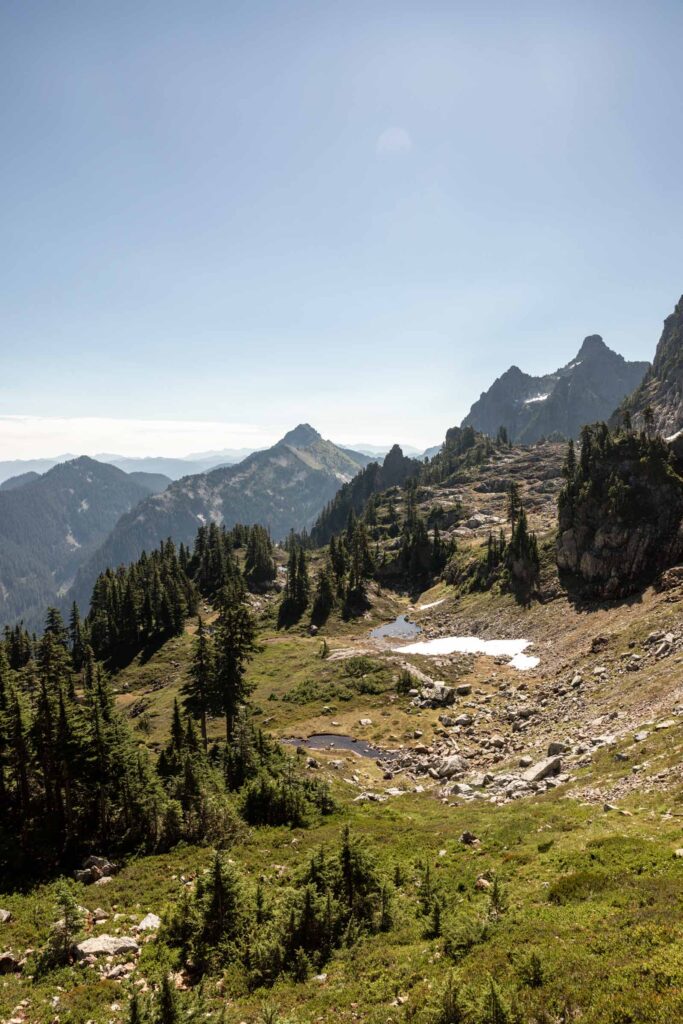
Pat yourself on the back now cause the pretty views just opened up and you’ve done most of the hard work already! The trail gets less steep as you crest over the ridge at 5400 ft. From here, there’s a series of traversing and descending 100 ft to avoid cliff bands. You’ll be able to see Gunn Peak now and the boulder field that you’ll ascend. It’s short and sweet, just about 500 ft of boulder hopping to find a hidden bench at the upper trees. I preferred the boulders over the slippery trail to the right of the ascent. Pick your own adventure!
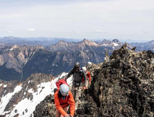
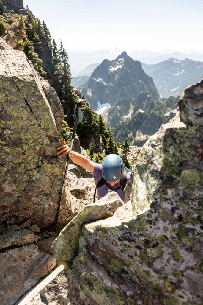
The trickiest part is the ramp to get past the cliff band. There’s 2 options, go up the gully with the chockstone, which is nearing a low class 5 move. It’s often wet. The other way around is slight to climber’s right but feels more exposed. This 10 ft section, whichever way you go nears class 4 terrain, so take care when going up and down. Once you pass this, you’re more in the clear, it gets easier again.
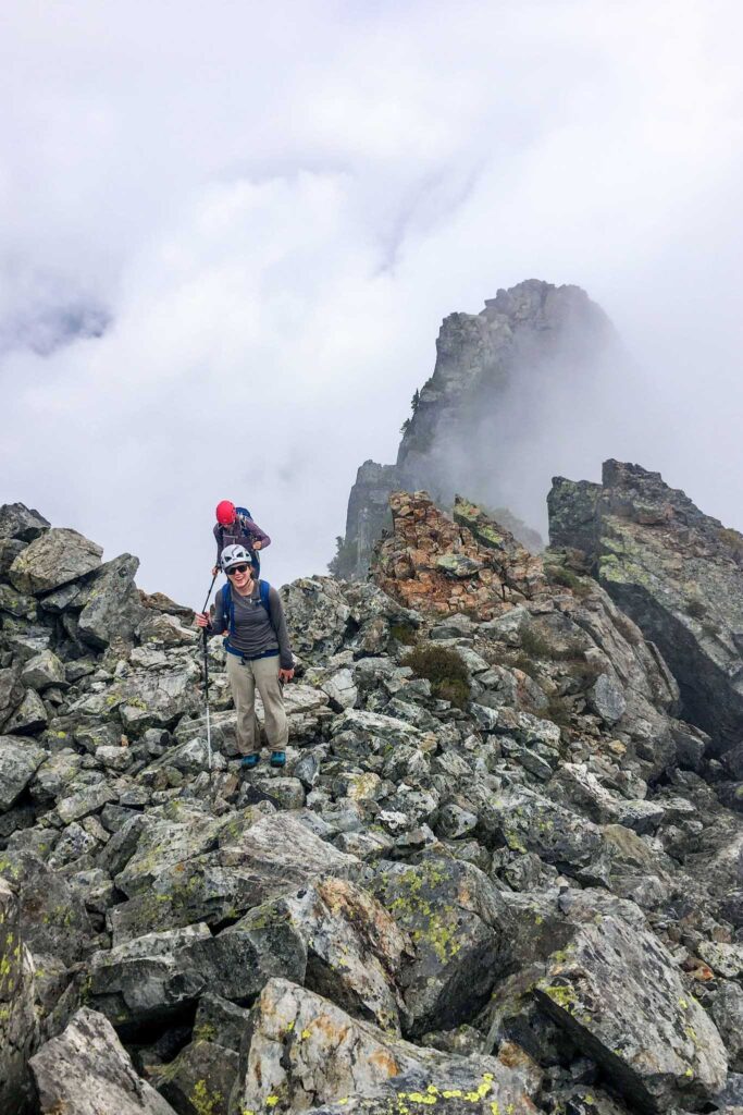
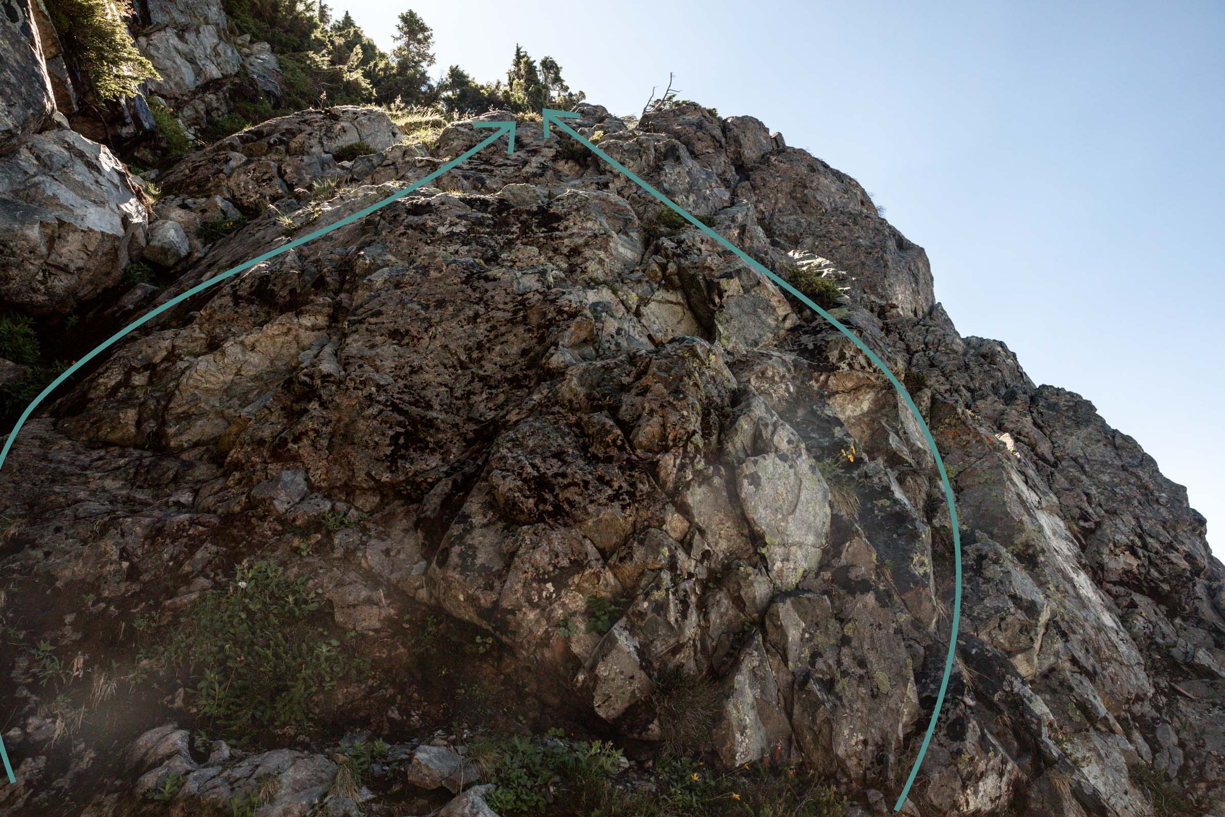
The trail is clear until the “obvious gully”. I know that’s every climber’s worst beta. keep traversing and climbing beneath the cliff bands until you see an opening to your left to climb up. The trail is clear and leads you to a notch to hop over. This is the one other move that might feel a little more rock climbing than scrambling but has good platforms on both sides, it wasn’t as scary as the ramp move, though that can be subjective.

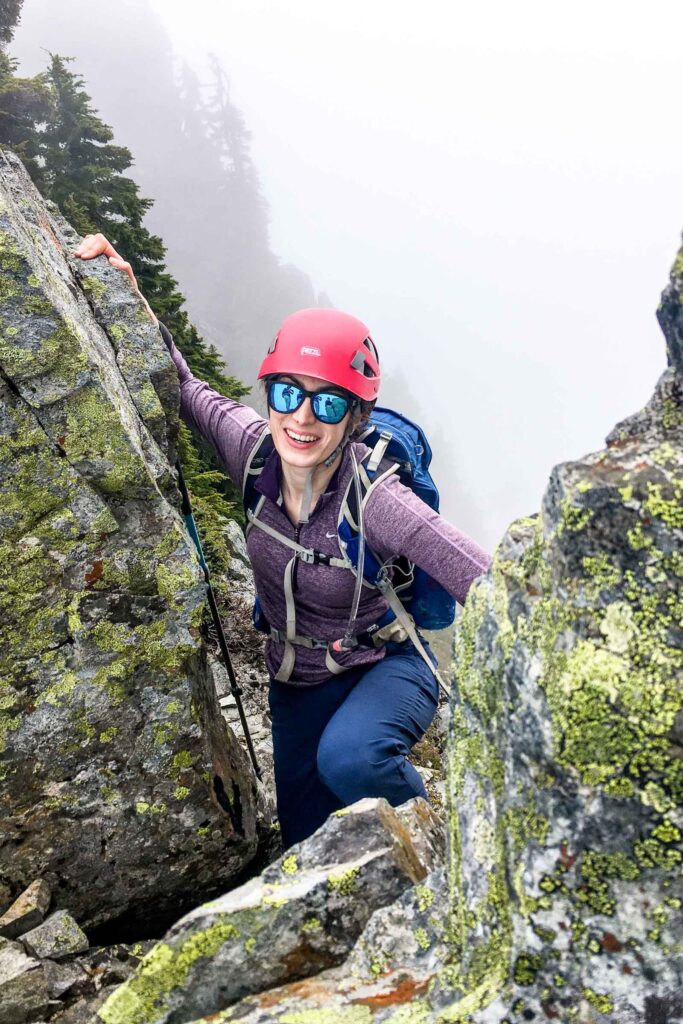
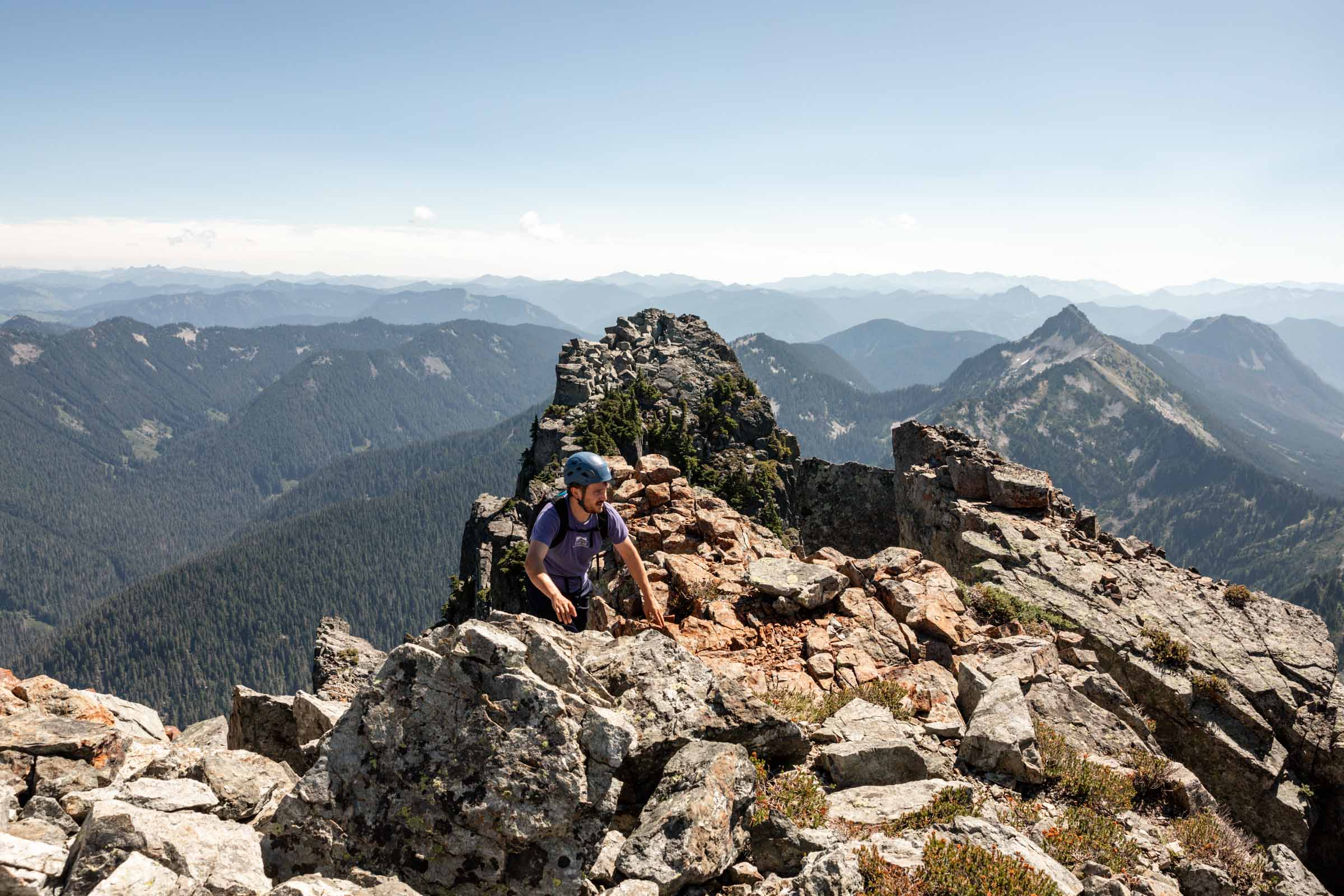
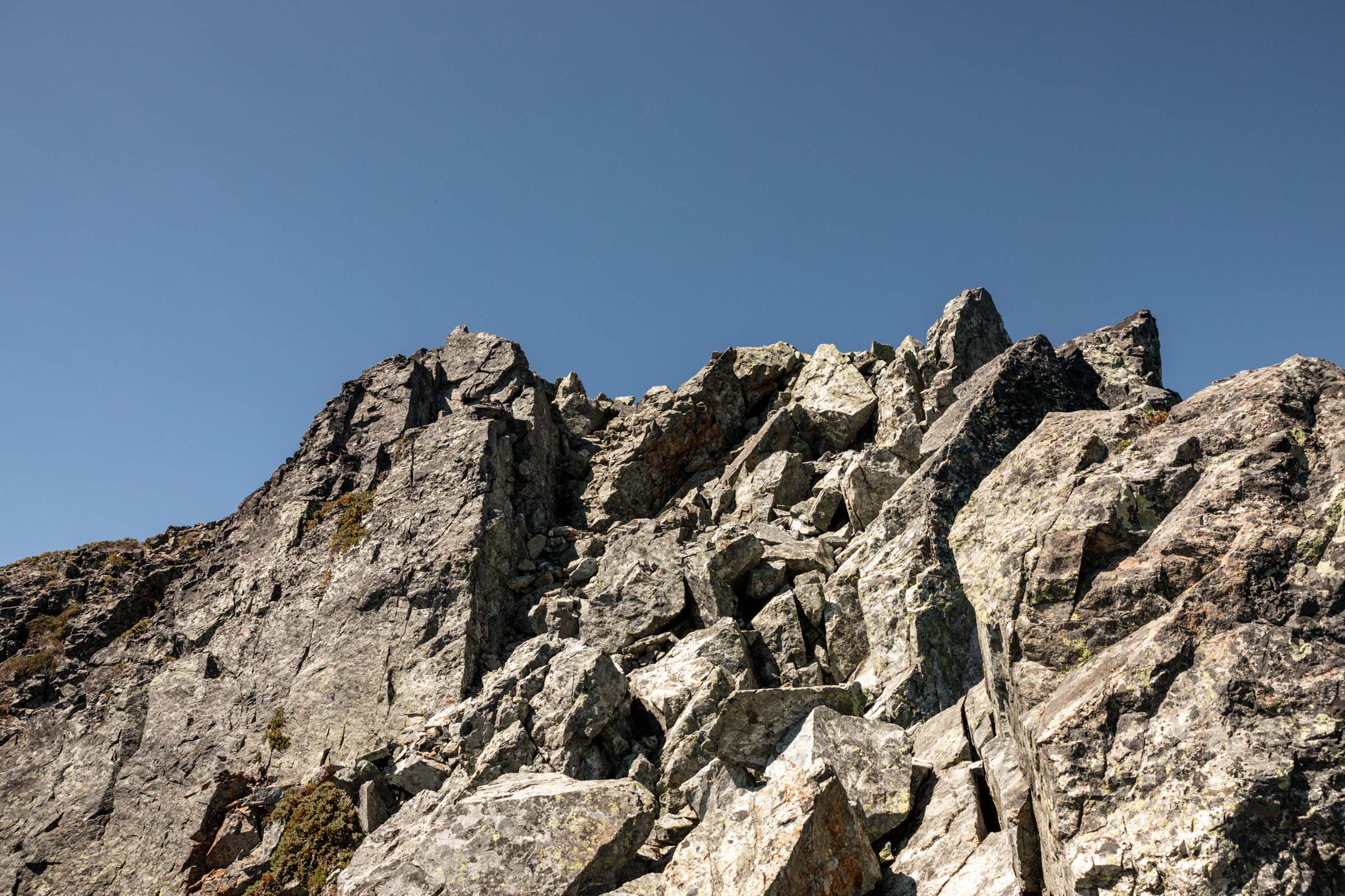
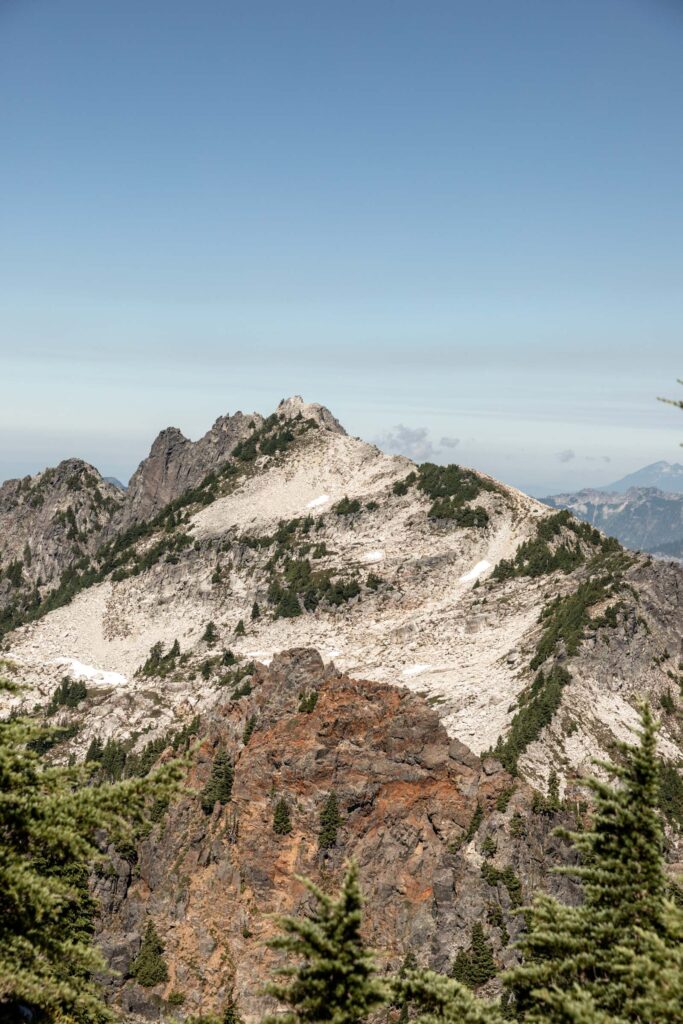
The next section is my favorite! Walking along a smooth granite wall. At the bottom is a steep drop off, so be steady in your walk, there’s plenty of space for your feet. If anything keep your eyes ahead and to the wall, don’t look down! From there, it’s a fairly easy scramble over boulders to the summit. Enjoy the views!!
To descend, retrace your steps. It looked like people left a rappel station above the trickiest scramble by the ramp. Up to you if you want to bring rope to descend. I’m a short woman and found that the down-climb was manageable. As time allows, hit up Tailgunner and Wing Peaks! Both only a couple hundred feet extra gain. Although I haven’t climbed those sub peaks, they look fairly straightforward to walk up, but use your discretion!
Note
- I was hesitant to write a trip report about this due to what seems to be a growing social media popularity here, but my personal commitment is to provide clear beta on scrambles for those new to scrambling and unsure where to start (see my main blog here). While nothing can be purely objective, I hope that my beta can at least give readers a very good leg up to self-evaluate whether or not this trail is for them and giving them confidence that it’s possible with the right skills and mindset.
- As always, please respect Leave No Trace principles and be cognizant of staying on trails when appropriate. Meadows are extremely fragile and it takes 5 steps to trample heather. Camp on rock when possible to avoid squashing the shrubs and ground foliage to preserve the natural land.
- Gunn Peak is even more of a climber’s trail than Mt Baring. I’d recommend ascending Mt Baring before you attempt Gunn.
- While seemingly short, it gains very quickly and the trail is always faint, though it is possible to stay on the trail and follow cairns the whole way to the top. Stay on trail to avoid “braided trails” or additional “social trails”.
Photos taken on Canon 5D Mark IV and iPhone SE


You May Also Like

take it easy | tomyhoi & yellow aster butte overnight
gatorade blue | panorama ridge via helm creek