mild adventure for tired souls | mt watson overnight scramble
15 miles . 5600 ft gain . 6234 ft high
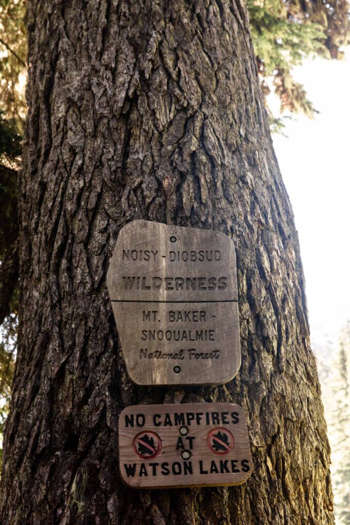
Noisy-Diobsud Wilderness
Note: The actual scramble is closer to 8 miles and a gain of 3000 ft.
I think I’ve been on more plan B trips than I could count on my fingers. But not only was this a plan B, it was also redacted during the trip. That’s a pretty terrible intro to this, but I’ll preface with the fact that Watson was incredibly fun and worth this trip report! Our original plan here (not plan A) was to tag Bacon and Canadian Bacon, just fun peak names to tag. On the map, it seemed all pretty straight forward to get to Bacon. We wanted to get a high camp view, but as you’ll read here, we did not accomplish that.
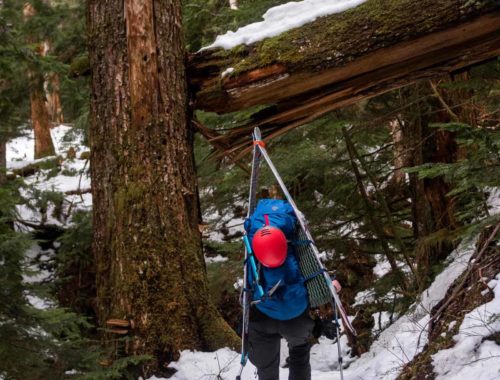
To beat the heat, we decided to leave home quite early for more cool temperature start to our hike. The road to the trailhead had some pot holes, but overall was smooth and great for my low clearance car. Mosquitos and other bugs already swarmed us once I put the car in park. It was a go-go-go situation between putting on sunscreen, using the pit toilet, and re-packing bags. Hurry before the bugs get to you!

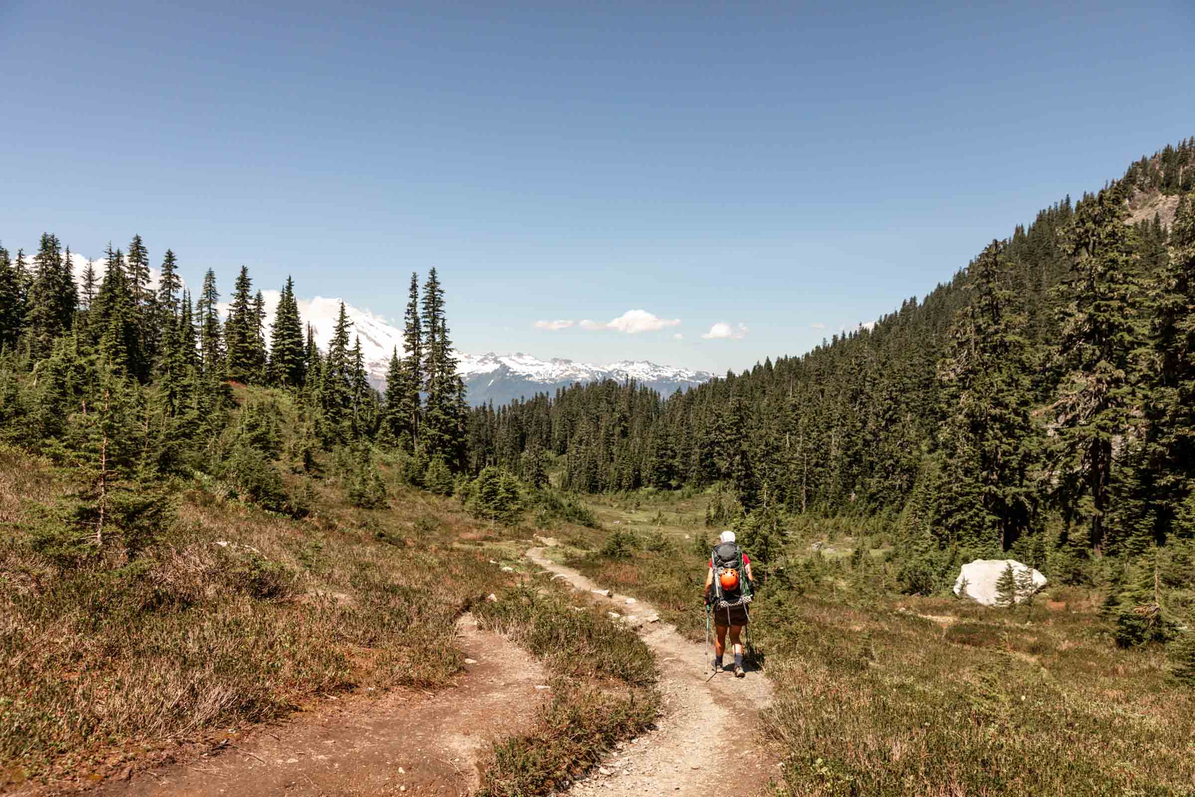
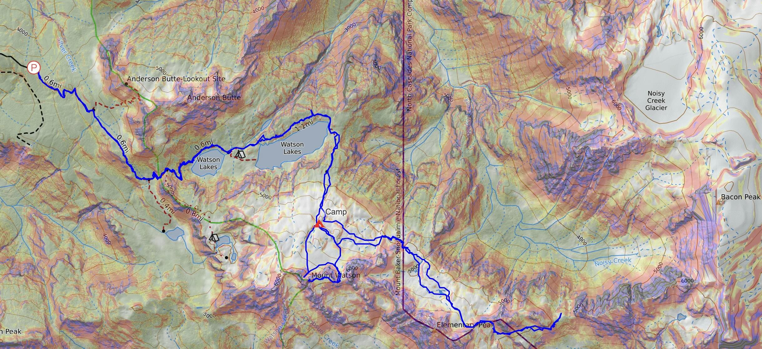
Thankfully, I had brought some DEET-free bug spray with us, which was a lifesaver! It didn’t last long, but it worked so well. Starting off in shorts and short sleeve, we already felt the heat getting to us. Even the first 200 feet felt hard. What the maps don’t show well is that there’s a small basin that you climb in and out of just to climb back into the Watson Lakes basin. If you’re headed towards Mount Watson directly, you can take the Upper Anderson Lakes trail to get a shorter access point to the mountain. We didn’t want to deal with all that, so we chose to go around the lakes for what we thought would be a more minimal gain to Bacon.
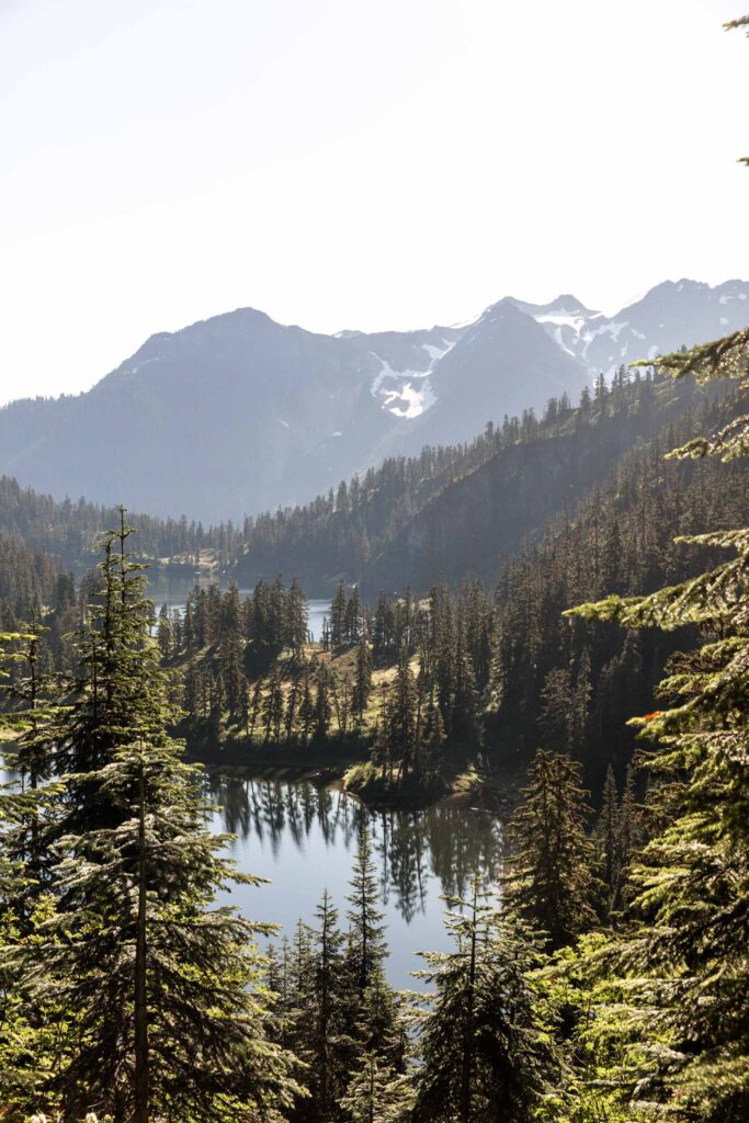
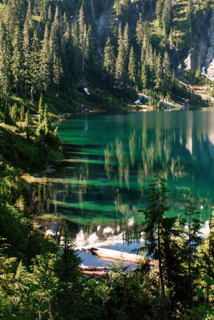
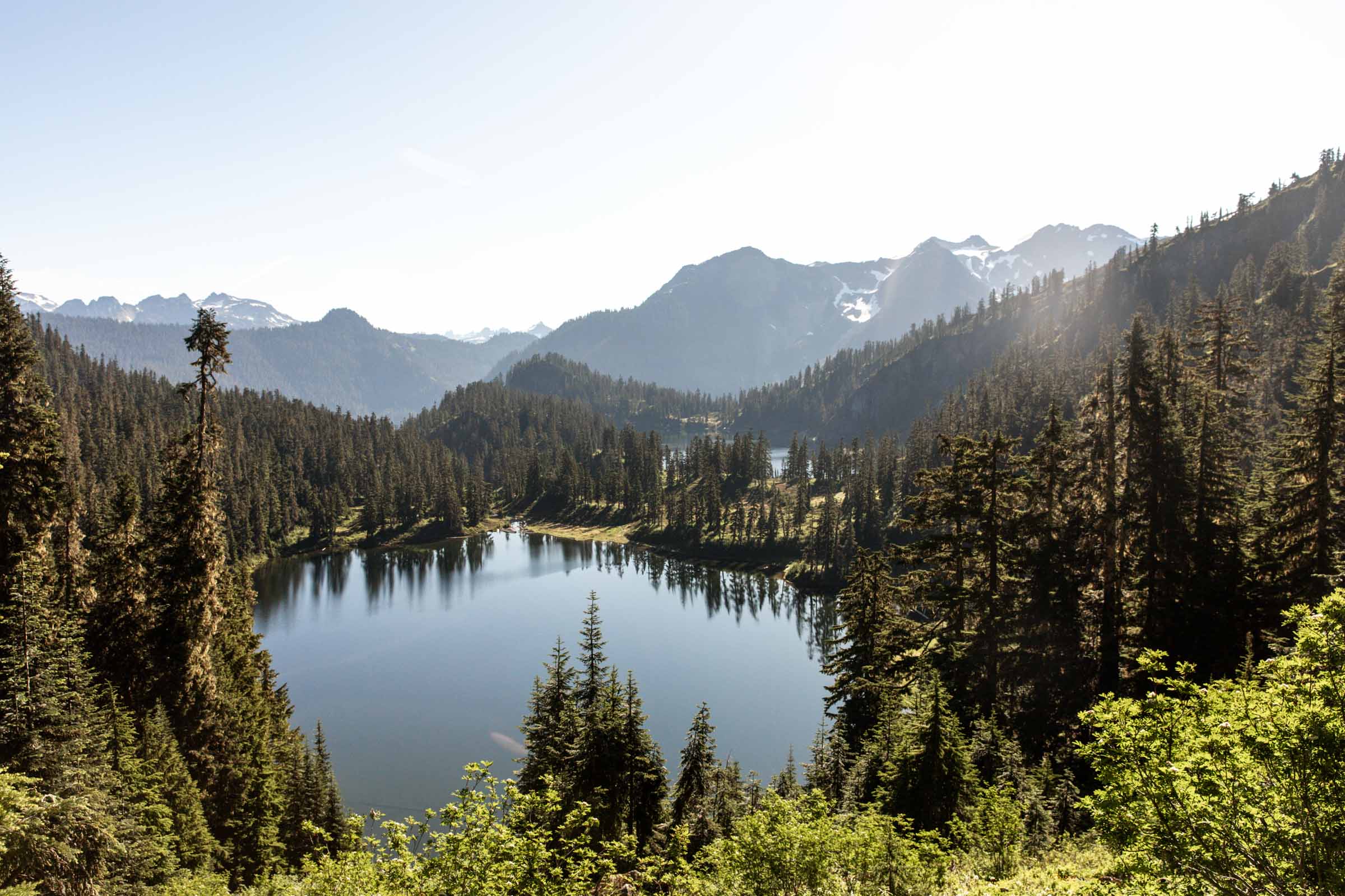
Pro tip: Camp at the lower (further) Watson Lake. It’s larger and boasts the pretty blue colors.
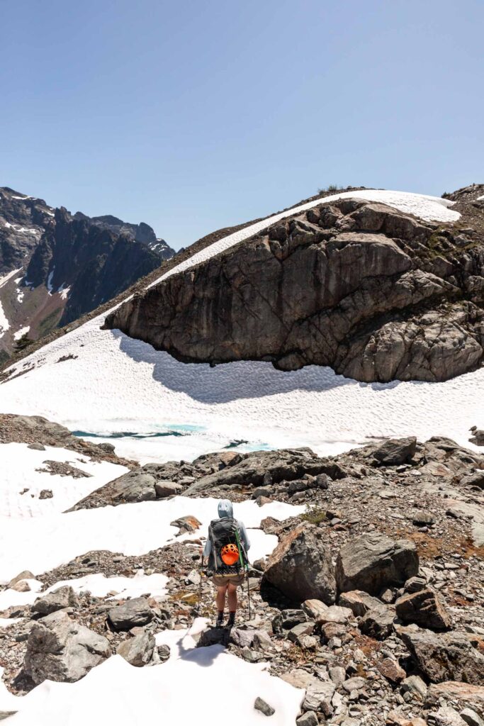
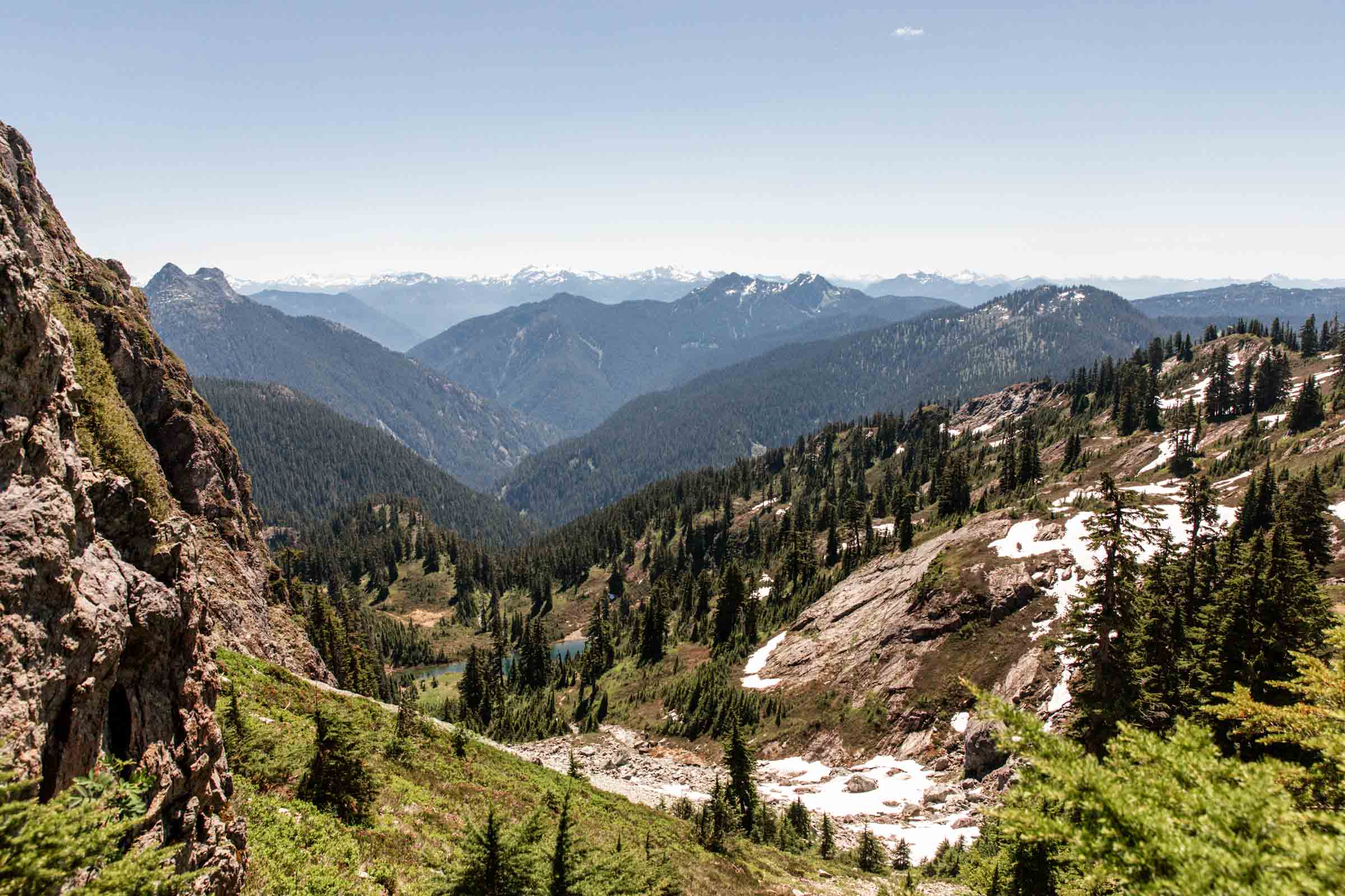
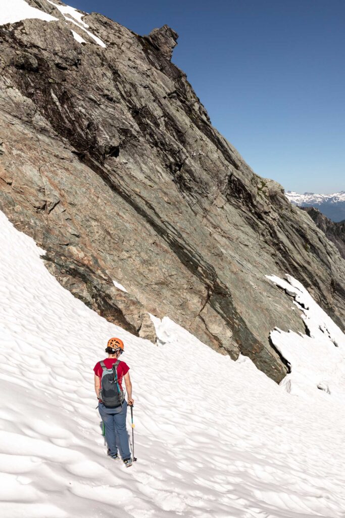
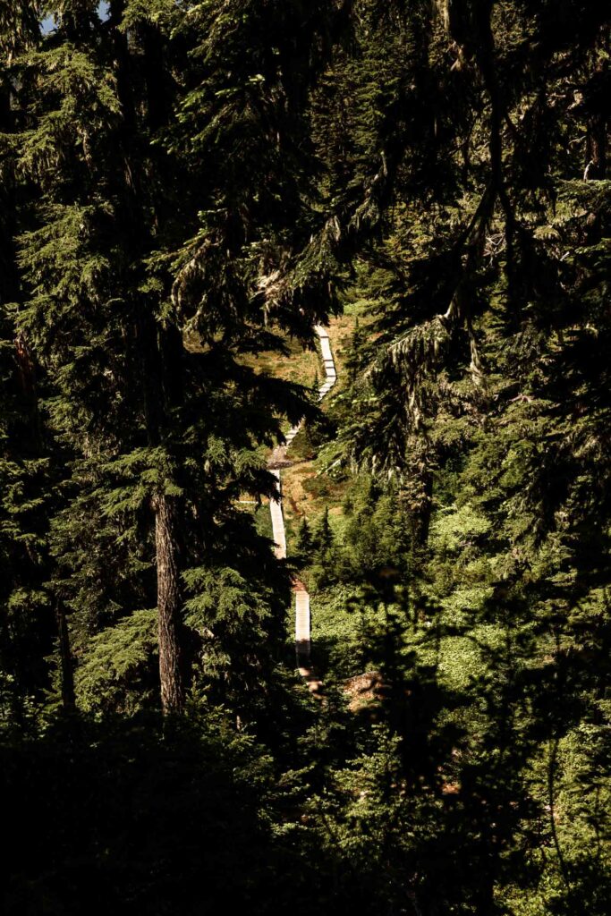
The trail along Watson Lakes was such a lovely one. Immediately as we rounded the corner of the second lake, we started our gain towards Mount Watson. The trail gets faint quickly and soon we picked our way up a talus field and onto the snow. There’s many ways to traverse across the slopes, but we end up following the consensus of the gpx tracks we downloaded to our phones.
If you’re only looking for Watson beta, skip the next couple paragraphs.
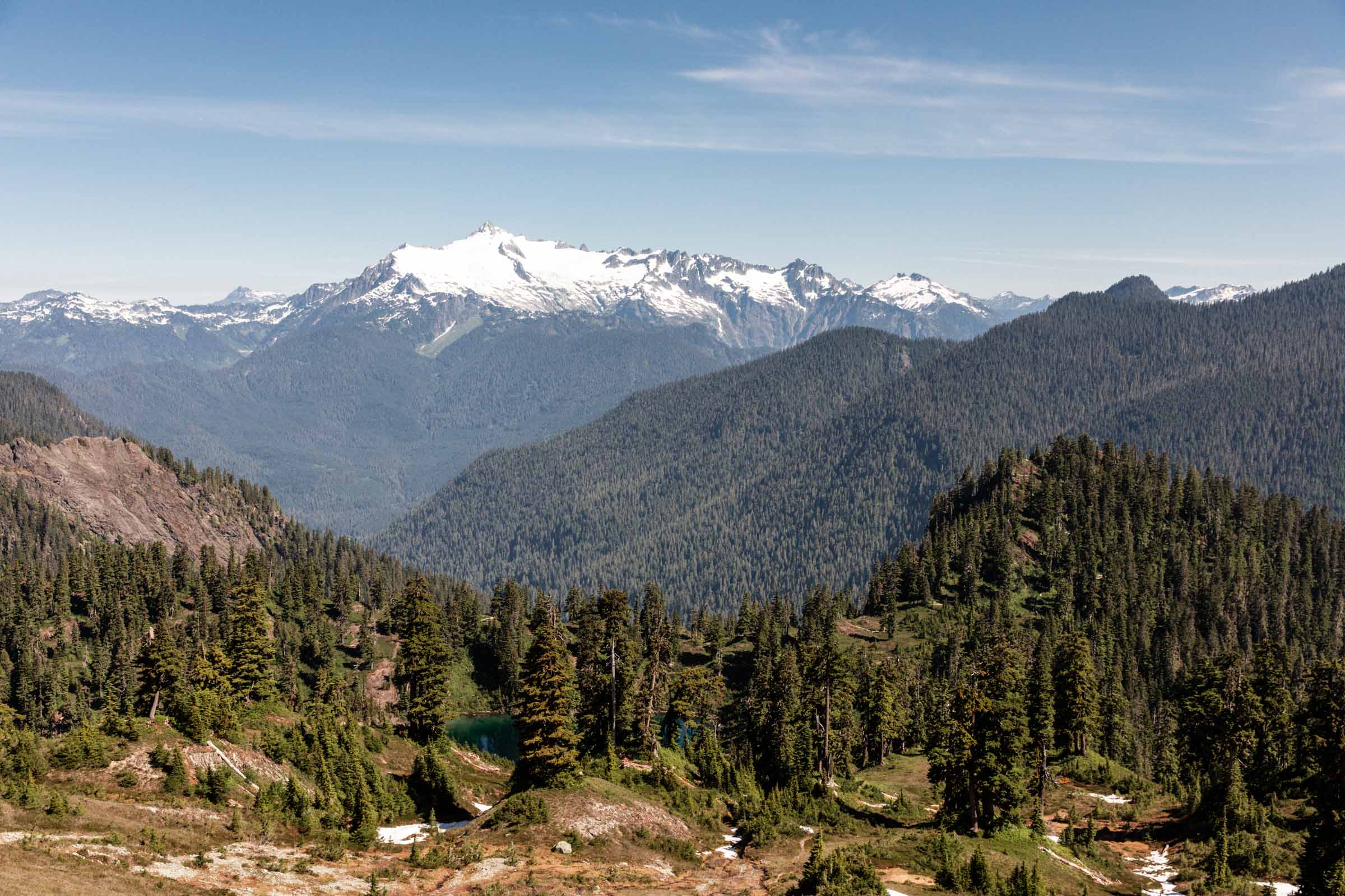
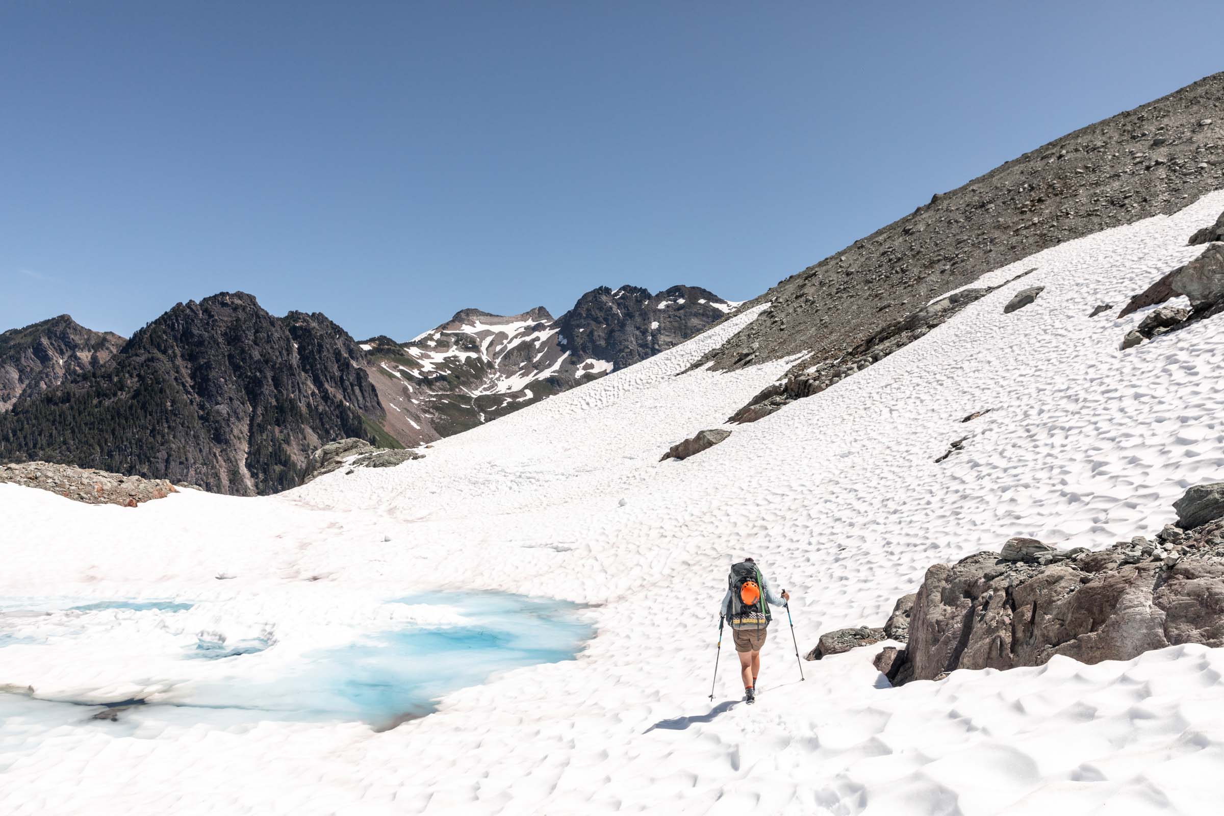
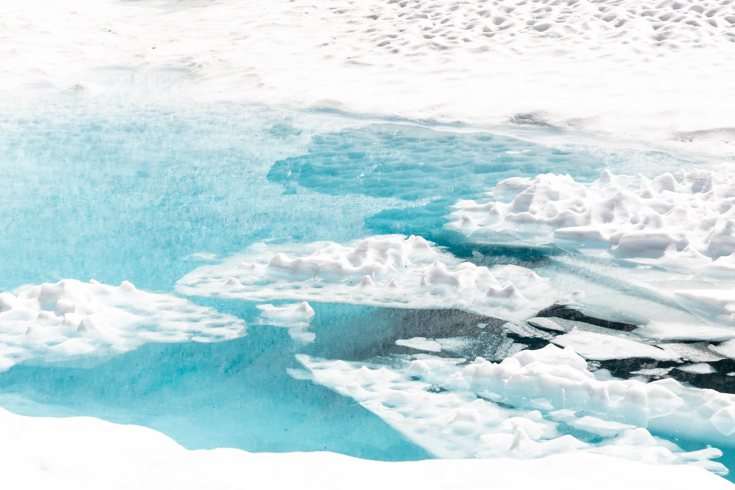
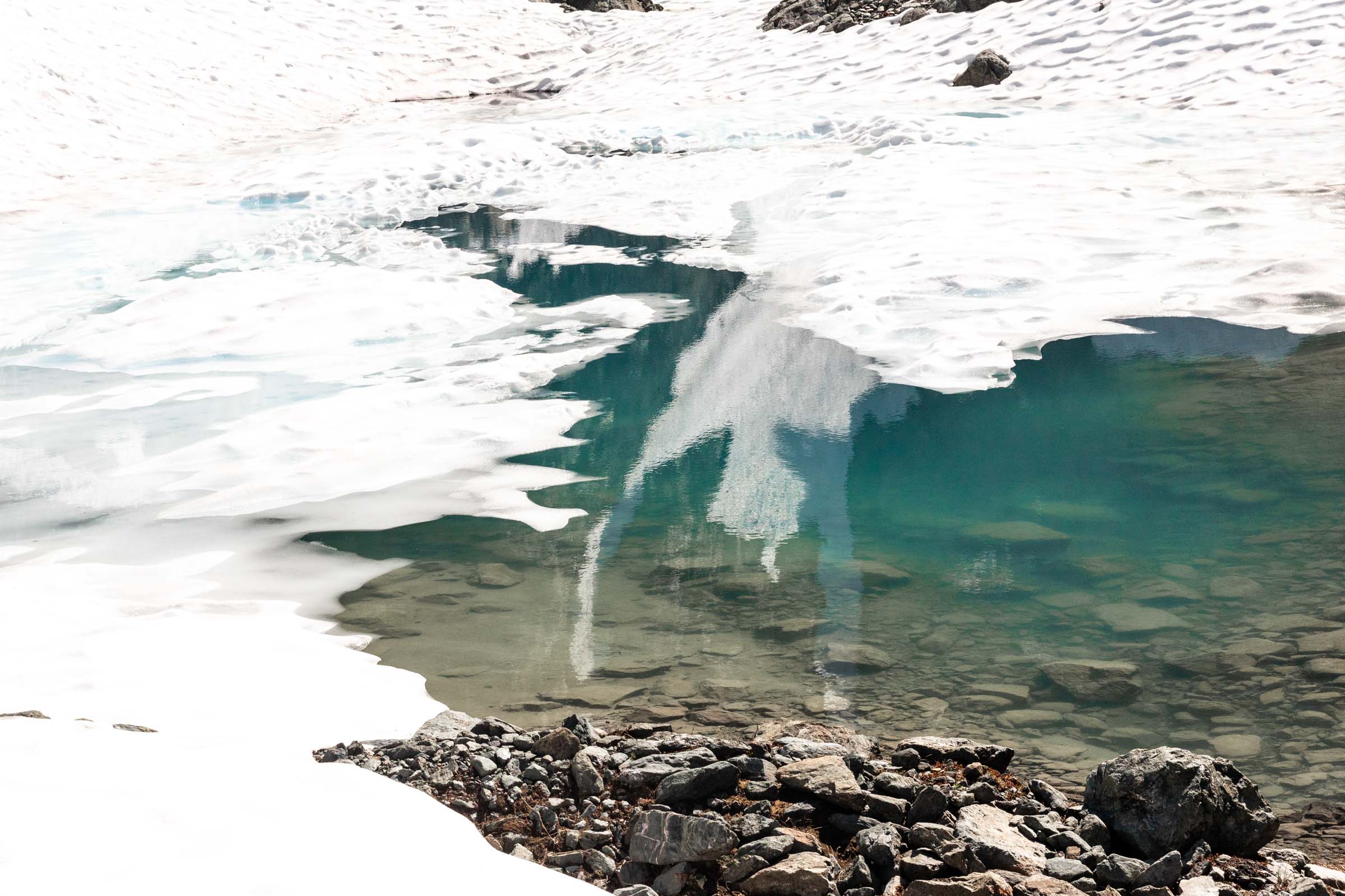
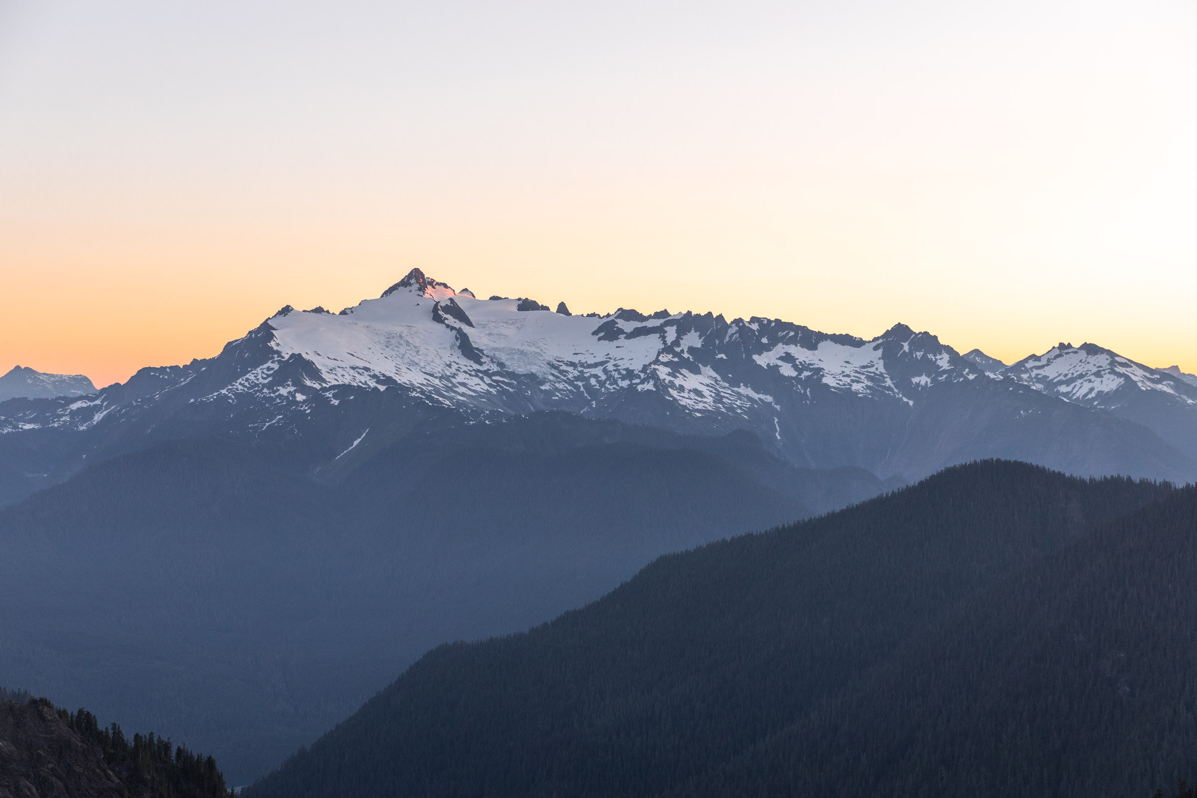
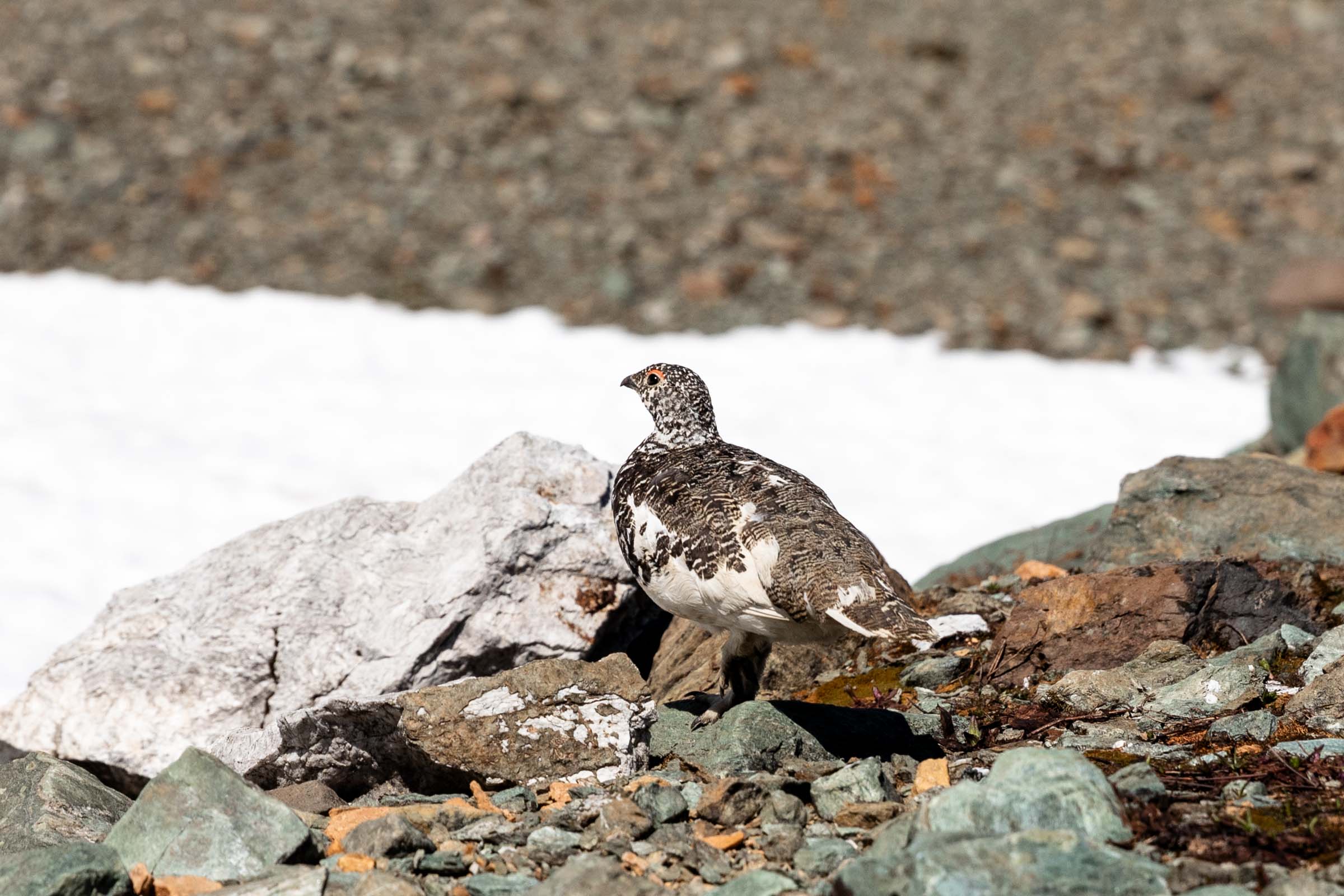
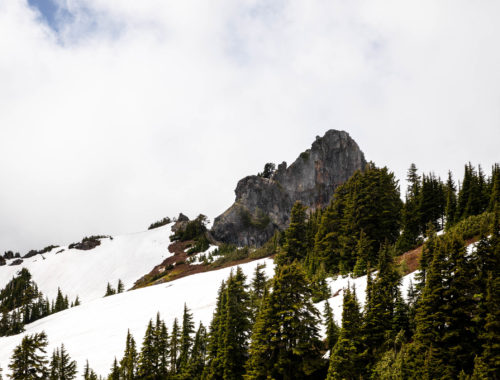
Unknown to me was how perfect we timed our visit to this area. I’d never been in the Noisy-Diobsud Wilderness before, so it was like checking off a new place! Beneath the Watson and Elementary peaks were little lakes that seemed to be partially snow-covered by a dying glacier. I wasn’t sure if those lakes would have that enviable baby blue, but indeed we found the lakes just barely melting. The baby blue was unlike any I’d seen before! We navigated over the snow and continued pushing further. All along, we could see Bacon Peak taunting us in the distance. How long would it take till we got there?
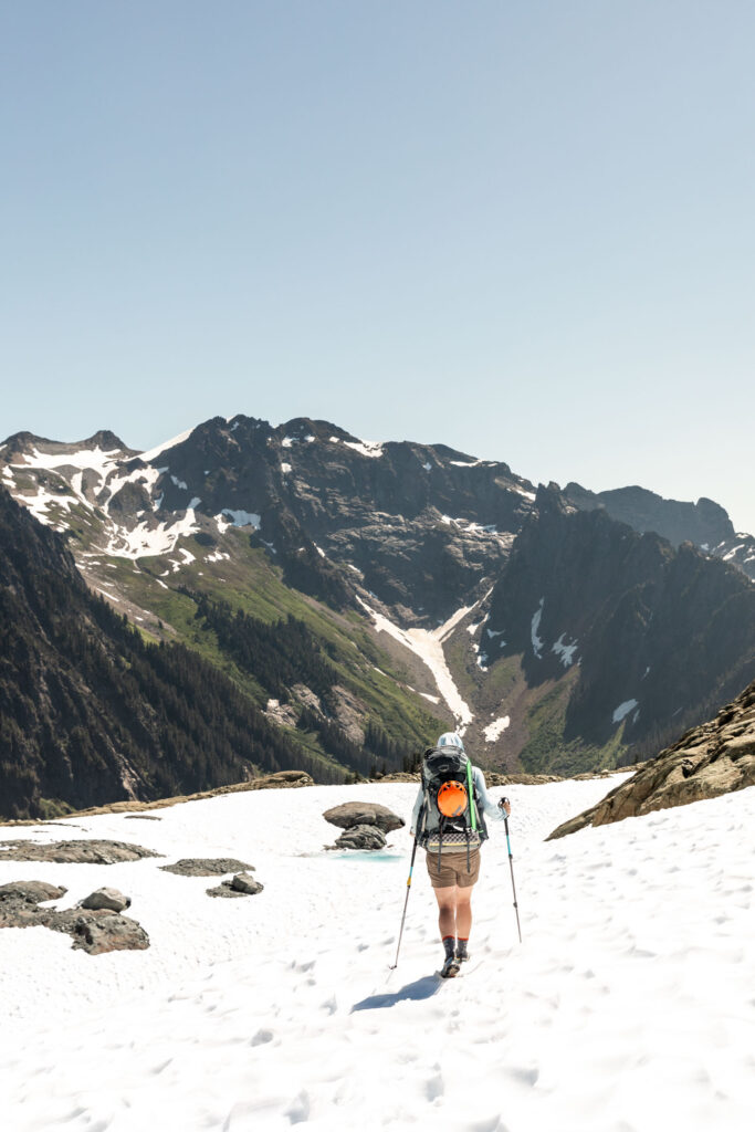
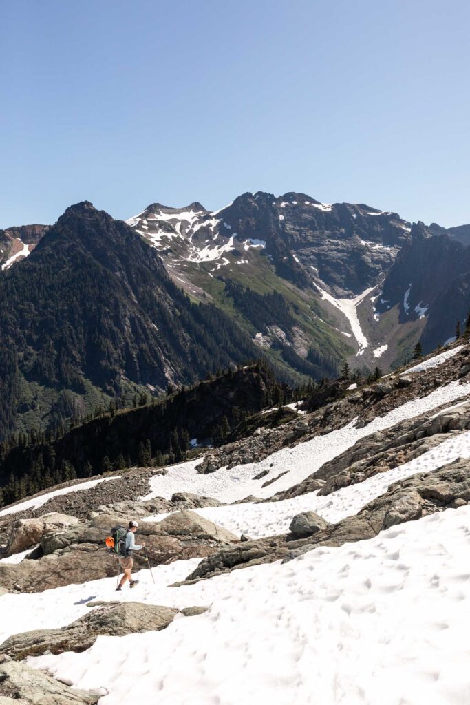
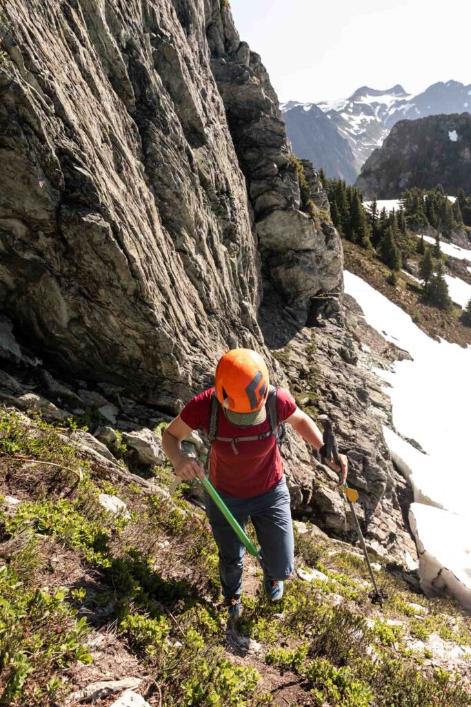
The snow travel was a lovely break from the heat. Every time we had to step across some rock, it would feel too hot. Our leisurely breaks could only be so long before the bugs or the heat would get to us. As we treaded the border between the National Forest and National Park, we descended a south facing basin near Elementary Peak. The sidehilling and bushwhack was not what we had imagined. We’ve both faced harder terrain, yet with the beating heat, we could not fathom any more beyond what we did. We were traveling a 1/2 mile every hour. That is slow by any standards of mountain travel!
We successfully passed 2 steep ridge cliffs before getting to the final saddle that would require more annoying heather to descend just to re-ascend another 3000 ft to get to our desired camp. 2000 ft if we want to bail to an earlier camp. It was already early afternoon, how long would it take? Probably slow. Probably more hours than we’d like. Probably late and cranky for dinner.
So we made a conservative decision to bail and retrace our steps back to beneath Mt Watson. It both felt freeing and disheartening to bail yet on another objective after I had previously bailed in the Cascade River area. The return took just as long of a time, affirming our decision was correct to turnaround. It’s hard knowing that we could go further but not knowing if it would have made sense.
If you’re looking for just Mt Watson beta, continue here.
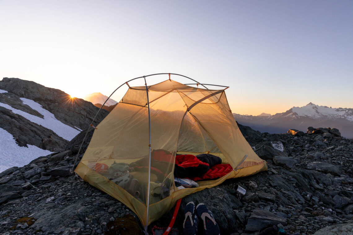
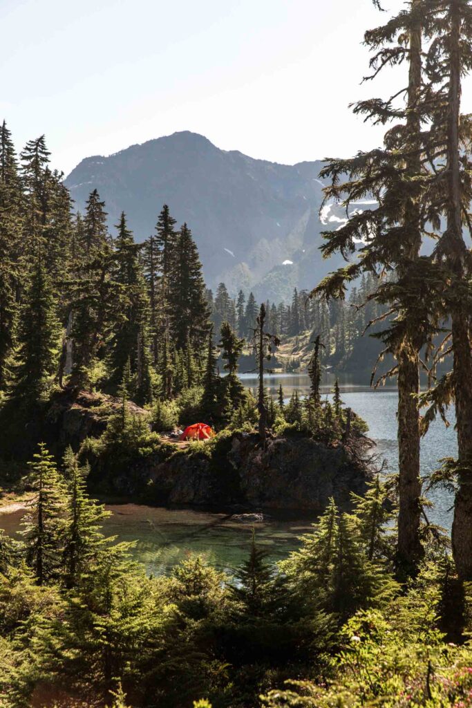
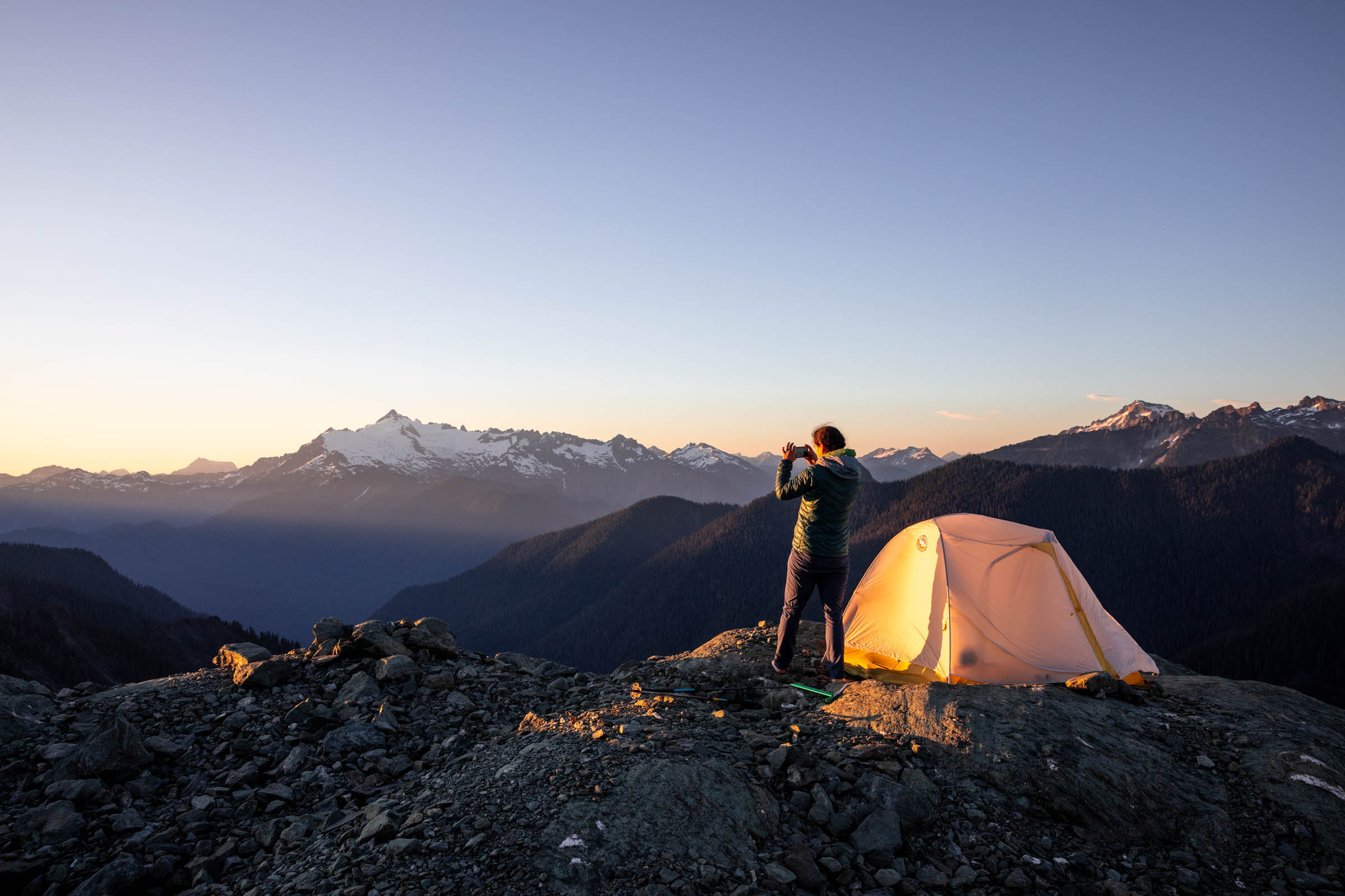
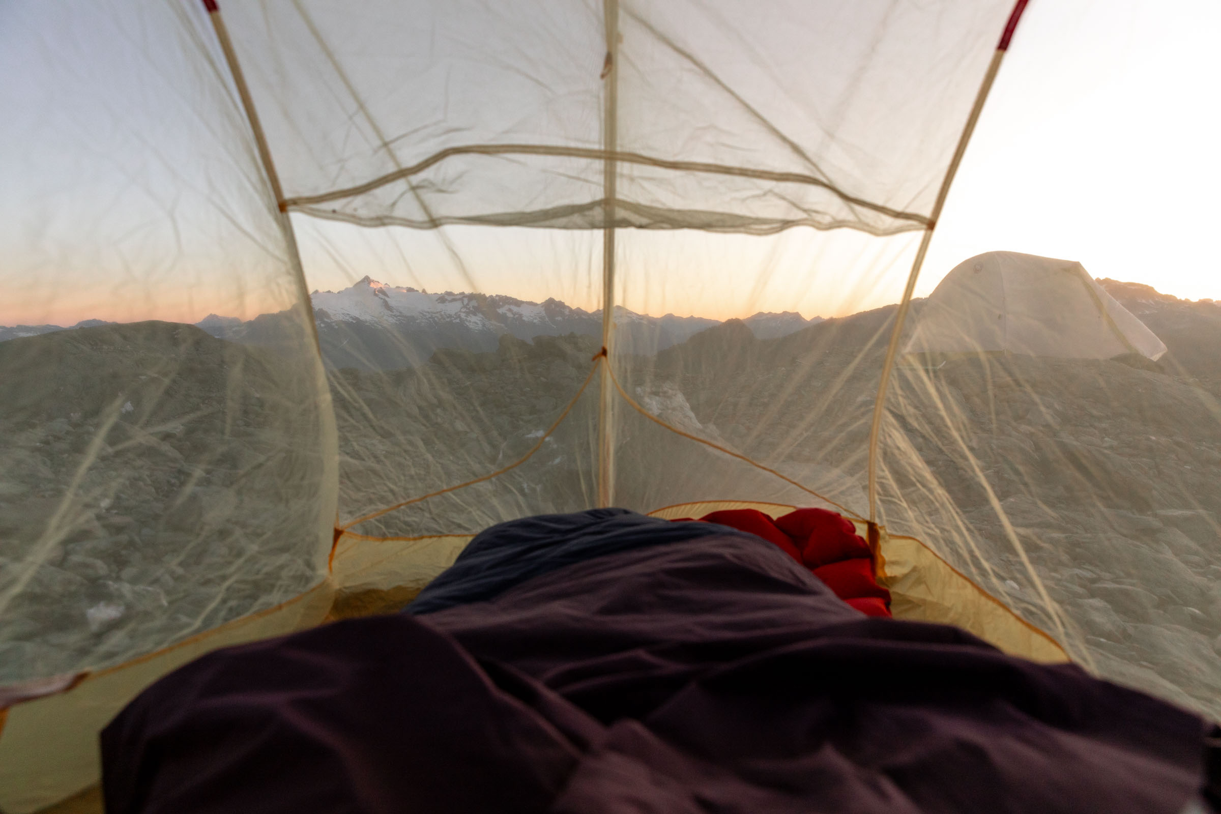
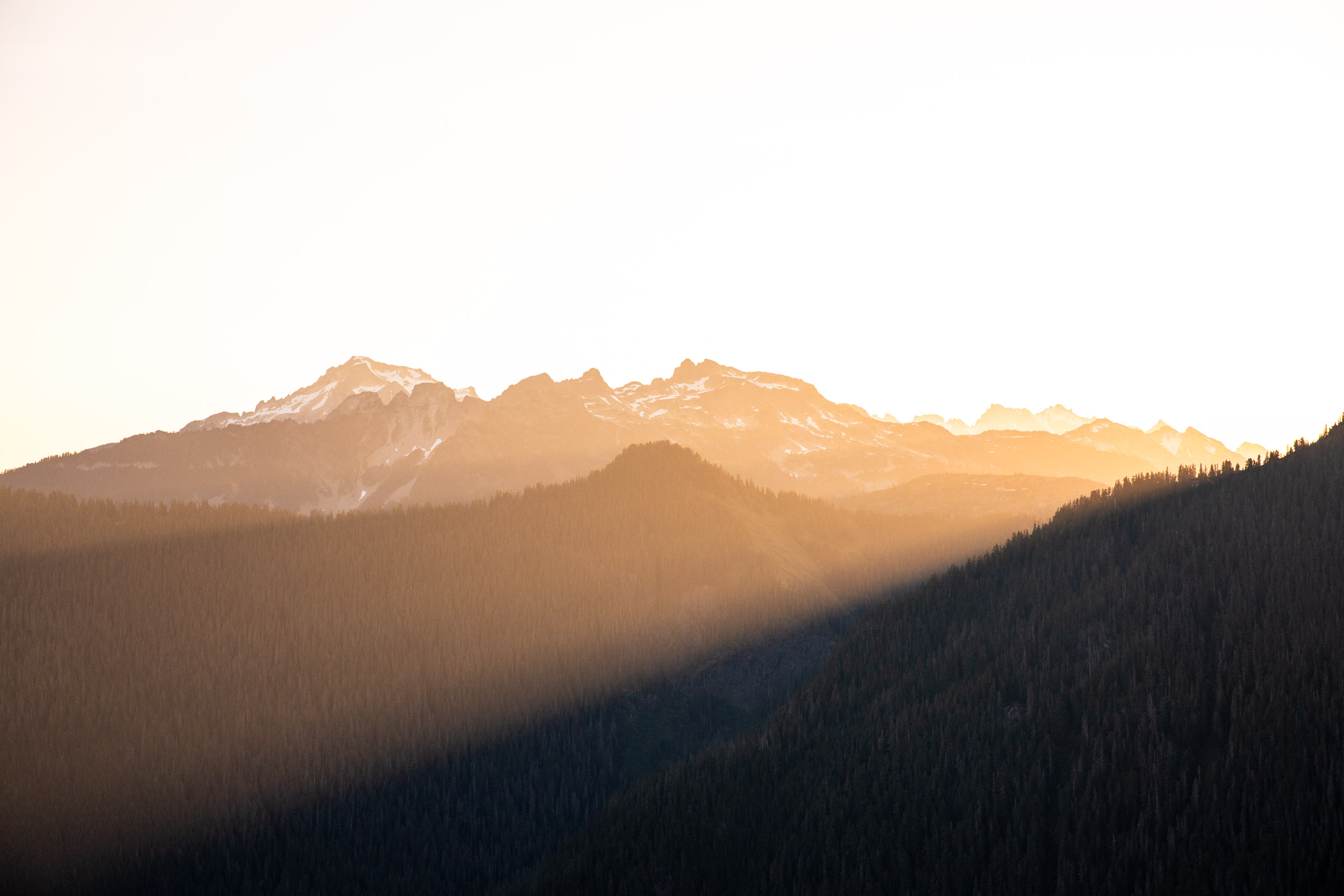
It was amazing turning a slog of a trip into something fun! We found camp around 5400 ft on the slopes beneath Mount Watson with views of Mt Baker and Mt Shuksan. While not as jaw-dropping as a 360 summit view would be, we still had a marvelous time enjoying camp. We were far enough from the lakes to feel solitude and high enough for the wind to blow away those pesky bugs. It definitely was good that we couldn’t see the lakes and see how long of a detour we took just to get back to the same spot.
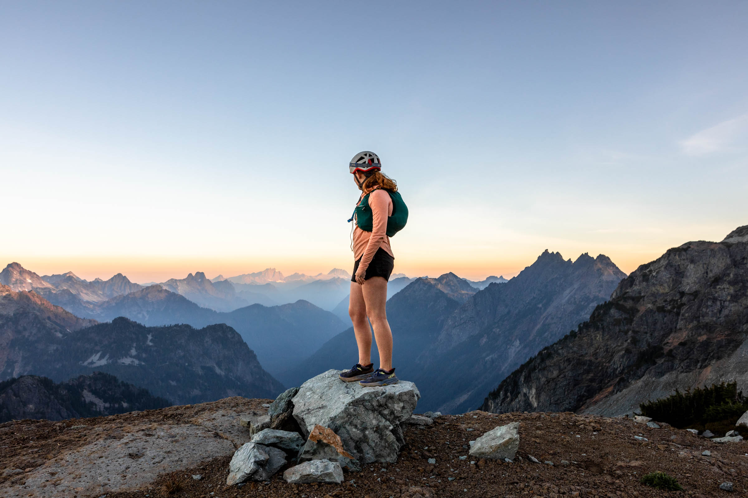
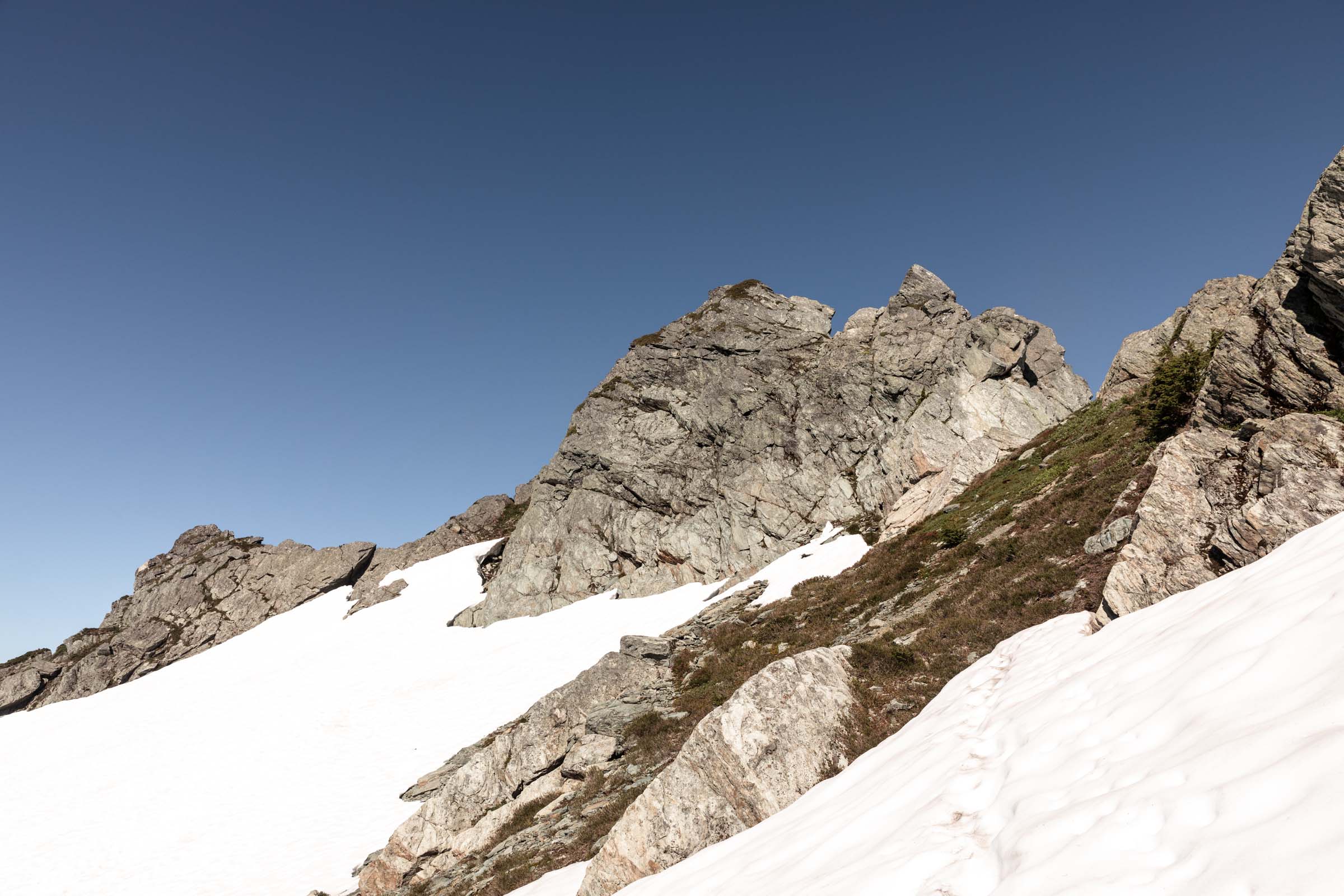
In the morning, we saw a bit of the sunrise before we decided to head on up and climb Mount Watson. We tried going straight up the west gully, but a large moat and looming snow bridge alarmed us. We retreated to go around the long way to the east gully, which was much more stable and in much less terrifying conditions. The ridge felt like a walk in the park and only a couple steps in steep snow or soil before the final short scramble. We found a faint trail to follow that lead us up to clamber between trees.
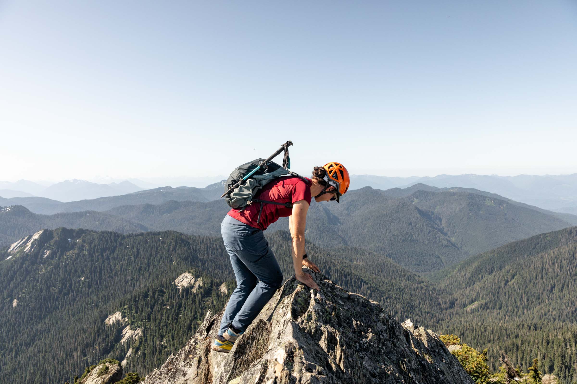
The final move to the summit was the best! It was airy, pointy and definitely takes your breath away. I would agree with the class 2-3 rating with an airy top. We didn’t feel the need to have a hand line, but it’s definitely not a scramble for everyone. Once we got our fill of the summit, we turned back around to find our stashed camp gear. A lazy time to repack and filter water and we were off on our short hike back to the cars. I have to admit, the trail walk was harder than I’d like to say, given the heat. But thankfully, every uphill was short and we were in no rush. I was thankful that we decided against Bacon Peak. We’d have to tear down camp before the crack of dawn to make it back to the car in time for scheduled appointments!

Notes
- There’s plenty of campsites all along Watson Lakes. There’s a pit toilet somewhere too!
- No permits required as long as you camp by the lakes or under Mt Watson. Further east is the North Cascades National Park, which requires permits.
- Mount Watson can be approached from the Upper Anderson Lakes or Watson lakes. You could do a loop if you’re not camping! Easiest way up is approaching Mount Watson from the north and taking the widest gully east of the peak that takes you to a saddle at 5900 ft. Traverse along the ridge and then across a steep slope to wrap around the base of the summit block. A short, steep treed scramble leads to the airy top.
- Title courtesy of Colie P
Photos taken on Canon 5D Mark IV


You May Also Like
out of the woods | three fingers ski
still aways | stillaguamish peak