25 feet below 9000 | black peak scramble
6700 ft gain . 8975 ft peak . 13.6 miles
Disclaimer: Black Peak is not black. I don’t know how it got it’s name. Places like Red Mountain look red and Granite Mountain is a pile of granite. But Black Peak is pretty multicolored and not black. And Black Peak is an awesome scramble. 10/10 would do it again and again.
Originally, I wanted to climb Luna Peak over a long weekend, but weather turned south and I decided to go further east to escape the potential rain. I was recommended Black Peak for its sweet views and climb. I was also stoked about this option because it would still allow me to explore the North Cascades, which is normally a far drive for a day trip. Although my friend had climbed a 5.3 route (see his post), I quickly learned that the scramble up Black Peak is a crazy, fun route and gets you 25 feet below 9000 ft (one of the tallest non-volcanic peaks in Washington).


With time on our hands, we opted for a longer route via Maple and Heather Pass to reach Black Peak and the easy South route to scramble up. I’m so glad we took this path because we got experience 4 lakes along the way and beautiful, beautiful scenery. The loop began at the popular Rainy Pass Trailhead. Lots of parking and lots of cars! It’s probably a good idea to get there early in the morning, whether or not you’re doing an overnight trip because there’s a lot of day hikers doing the loop around the two passes. We registered at the trailhead and headed up the steep route towards Maple pass to get in the extra mileage earlier rather than later. This is the clockwise direction of the loop. I believe the counter-clockwise direction is more well-traveled.


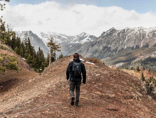
The steep climb allowed us to quickly gain elevation above the trees, which then allowed the views to open up to the mountains nearby, including the ever popular Washington Pass, a climbing mecca to the east of us. It’s pretty easy to spot the spires sticking out from the smoother surrounding summits. And of course, Liberty Bell is quite iconic! As we climbed up the trail, we started seeing views of the trail on the opposite side of the basin, but the first wow moment was when we saw Rainy Lake to the left. The gorgeous blue water so far below us against the rocky walls and green pastures. Just as soon as Rainy Lake started to fall behind the trees, the views to our right cleared up. And there was Lake Ann, and aha, Black Peak in the distance. It’s pretty cool to be able to see your final destination all along the trail while being entertained with so many other views.
Although we still gained elevation towards Maple Pass, the grade had decreased and it felt more like an easy traverse along the ridge. With fresh wild berries lined up all along the trail, it’s hard not to find the hike enjoyable. Maybe it’s because we stopped so many times to feast on huckleberries and were well rested, or maybe we had too much fun frolicking in the alpine. But either way, I was definitely not dying at the top of Maple Pass, a nice contrast to some of my past hikes where I pushed myself much more. Incredible view after incredible view, we had a nice lunch break on a vista point above the pass, towards the direction of Frisco Mountain and Rainy Peak. On this high point, we could even see Glacier Peak!
Post lunch break, we headed down to Heather Pass, some 1000 ft of elevation loss. Quite the pleasant hike with a few switchbacks and many more berries to feast upon. We met a couple who lost power on their phone and couldn’t figure out the turn-off from the main loop to the climber’s trail towards Black Peak. We shared our map with them and I think they must have hiked an extra 500+ ft in elevation past Heather Pass, where the side trail should have been. Looking back, it seems that the turn-off was less intuitive come from the parking lot (counter clockwise) side than from the uphill side.


From the Heather Pass, the narrow trail continued further down into the boulder jumble jamble. I thought it was pretty fun to hop along rocks, but for those unfamiliar, it can be tricky to navigate between rocks. When I first started out doing more technical hikes, I was pretty slow when learning to travel on various terrains. You’re trying to balance yourself (and your pack) on slanted rock and meanwhile avoiding the deep, dark holes where you might twist an ankle or two. I’ve found that with practice, I’ve learned how to quickly see where good foot placement is and how to counter balance each step carefully. Very glad for friends who’ve shown me it’s possible to move quickly, yet calculated over a boulder field.
The boulder field is probably most people’s least favorite part of this hike/scramble. But, at least it’s not for too long and you can see Lewis Lake enlarge before your eyes the closer you get. The views of Lewis Lake are not clear until you get right up next to it. And boy, was it beautiful. I don’t think I’d ever get tired of seeing alpine lakes. I love how blue and pristine they are! Makes you want to jump in and just soak it all in.


I was surprised by how many people found campsites around Lewis Lake. From my curt, last-minute research, I thought that Lewis Lake was unfavorable for camping and Wing Lake further up was much nicer. Also it’d be a shorter second day hike if we camped higher. So we followed the cairns around the north side of Lewis Lake and headed the steep trail up to Wing Lake. This, I’d argue, is the hardest part of the hike. Just because every lip over a hill you’d think you’d reach the edge of the lake, but you’d then find another hill to climb. It seemed like never-ending hills if you kept the GPS in your pocket. I did enjoy the beautiful views of the larches (so excited for them to turn golden yellow) and looking back at views of the sky-blue Lewis Lake.
We started to feel a few raindrops on our arms and faces as we slowed down up the last climb. And just as our spirits grew a bit heavier, we were at the lake! With our packs off, we breathed in the clean air and stood in awe of Wing Lake and the towering Black Peak. The first clearing was quite big and open with the perfect rock table. It even had a nice fire pit! I was used to no fires above 5000 ft in the Alpine Lakes Wilderness, but I guess this is not a restriction in the Okanogan-Wenatchee National Forest. Since this campsite was the first one off the main trail, we knew there’d be higher traffic and less privacy, although there weren’t took many people comparatively anyway, so it wasn’t a huge deal.
We joked about doing the House Hunters: The Camping Edition. Or maybe The Wilderness Edition? Either way, it did feel like we were hunting for the best campsite. Since we took the long way around, most of the nicer spots were taken. The other viable spot not on vegetation we found was this small clearing on top of a little hump. One friend was commentating: will the trio choose the house with the view on the hill or the mansion with more land and amenities like easy water access? Surprise, surprise, we chose the mansion. We needed to fit 2 tents. Plus, it was still more private because we were less visible to other campers, just more visible to hikers passing by.
I set up my hammock and cozied up to enjoy the views of Black Peak. It’s so peaceful and calming to rest. There’s quiet chit-chat of the other campers, the occasional bird chirping, and the gentle breeze blowing, rocking me side to side. My peace was woken up by my growling stomach, so I proceeded to make dinner before watching the sunset glow. We’d gone to bed before the sky darkened, but I woke up again to groggily do a bit of astrophotography. The Milky Way was so clear! A couple other people were out to watch the northern lights too, but from the comfort of my tent, I was unable to witness that solar occurrence.


Some of the other campers had been thinking of a sunrise scramble, but my group wanted a tad more sleep. We compromised by watching the sunrise as we were scrambling. This turned out to be a better idea than watching the sunrise from near our campsite because the low clouds (perhaps the cumulus type) were sitting right beneath our campsite at 7900 ft, so we couldn’t even see the pretty valley below. We snoozed a few times, but quickly got up to repack our bags and eat granola bars for an easy breakfast. It was amazing to see the clouds move beneath us, which eventually started to envelope our campsite and then fall back down. In and out it would breathe. As we scrambled up the scree field, the sun rose higher, painting the clouds pink, then outlining it with its golden hue. We saw 2 people on the summit with their headlamps – people who actually made it for the sunrise on top! I’m amazed by their dedication.


The scree field may not have been the highlight of the scramble, but with the sunlight hitting the rock and mountain above us, the pain subdued. Approaching the ridge to begin the south route, we were amazed by the early light views of the mountains to the south. Especially Goode Mountain. It’s surprisingly photogenic from our point of view. I’d climb for a bit, soak in views of Goode, then climb a bit more. Solidly class 2 or 3 scrambling, few exposed sections and little need of hands to move up, unless you want to. Definitely not class 4, like a group was trying to tell us.
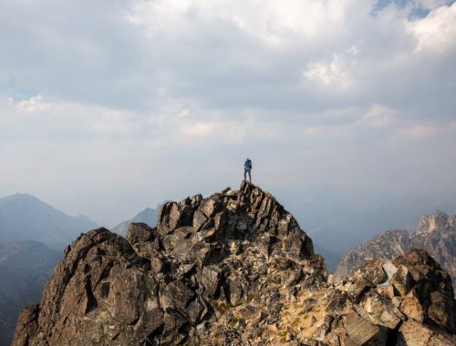
It was easy to follow the cairns up, but the summit was never in view until the last scramble up, which could be considered more class 4 scrambling. We reached many false summits. But every break, I enjoyed watching the clouds moving in and out. Sometimes we could even see Lewis Lake and sometimes we’d barely see Wing Lake and our campsite. Alas, we made it to the true summit. It’s a glorious feeling to be standing on top of a mountain. I always feel like I’m on top of the world, so free and wild. I encouraged my friends to join me too, but they were more cautious than me – I accept my risks for standing on a precarious rock.


We never saw the sunrise climbers pass us, since the next time was saw them, they were already down in the distance conquering the scree field. We took our time to savor the summit. 360 views all around, sun and clear. All the mountains around me were new too me – another challenge to start learning names of mountains in the north cascades. It must have been a whole hour of relaxation and appreciation before we heard voices off in the distance. People had started to make their way up. Just as the next group arrived, we started to down climb the summit block and then immediately met some 10-15 people. So glad we got there early to have the summit to ourselves. It would be hard to host that many people at once on the small top. Scrambling down Black Peak was just as beautiful as up.
Approaching Wing Lake, the bright aqua color resurfaced in replacement of the deep blue hue we saw from 2000 feet above. What a lake! Since we had summited so early, we had the rest of the day to lazily wander back to the car. This included a long break at camp and a laid-back teardown. Sauntering down to Lewis Lake, my face was beaming as the views of the baby blue lake grew and grew. I’m in love. Alpine lakes are just my favorite, a close second to standing on top of the world. With a final climb through the boulder field again, we were back on the main Maple-Heather Pass loop. Slowly, we descended back to the forest, saying goodbye to Black Peak and the larches of the Lake Ann basin. I can’t wait to come back to this area to explore more peaks in different seasons!
notes
- The route is fairly straightforward, although not marked. It can be done as a longer day trip but camping is pretty fun here too!
- Black Peak is a class 3 scramble overall, though there are short sections that might be a bit steeper. There are multiple ways up from the saddle above Wing Lake.
Photos shot on Canon Rebel T6
You May Also Like

teanaway getaway | johnson-medra-jungle traverse
May 22, 2025
spring bound | silver star mountain via silver creek ski tour
April 26, 2024

